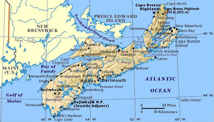
NOVA SCOTIA AND NEWFOUNDLAND
May 9–June 26, 2015
THE BIG PICTURE
We left home on May 9 in our motorhome towing the
Rav4 behind. We arrived in Milton, MA
in time for grandson Griffin’s graduation ceremonies at Boston
University. Two days later we drove to
Halifax, NS where we stayed with friends for three days, then
traveled through the province for about two weeks, seeing most of the
coastal areas and Cape Breton
(Part of Nova Scotia). We took the ferry to Newfoundland on June 8, traveled the
western portion of that province from Port aux Basques on the south
coast to St Anthony at the northern tip and returned to Nova Scotia eight days later. After
a major repair to the RV in North Sydney, we left Nova Scotia and drove
to visit friends in New Hampshire
and back to Milton in time for
Father’s Day and left for Colorado
a few days later.
[Note: It’s
appropriate that we begin writing this account of our on Canada Day,
July 1, which marks the anniversary of the joining of the colonies of
Nova Scotia and New Brunswick with the Province of Canada in 1867.
Newfoundland was a British colony until the British government granted
it Dominion status in 1907. Labrador had long been an area in dispute
between Quebec and Newfoundland; the British government, in 1927, ruled
that Labrador was considered a part of Newfoundland. The people of
Newfoundland voted for confederation with Canada in 1949.]
I. BOSTON UNIVERSITY GRADUATIONS
Our cross-country trip began during a week of
terrible weather stretching from the Rockies to New England. We were
almost constantly buffeted by strong winds, rain, and threats of nearby
tornado activity along I-80 through Colorado, Nebraska, Iowa, Illinois,
Indiana, Ohio, Pennsylvania, New York, Connecticut and ending in
Massachusetts. It’s about 2000 miles from here to there and with a
small car in tow it took five driving days to make what could be a
three-day trip in a car in good weather.
Griffin is our first grandchild to graduate from
college and we wanted to be there to see the ceremonies. Both Griffin
and his sister, Julia (who will graduate from BU next year) have family
ties to the University: Hughes’s uncle, Dr. Edgar Baker, taught in the
BU School of Medicine for most of his professional life before retiring
in the 1980s. Hughes earned his Master’s degree there in the School of
Education (1965). Our daughter took post-University of Michigan classes
there and later was hired as Assistant Director of Admissions for the
College of Engineering for three years; whe was later named Co-Director
of Freshman Advising for two years, also for the College of
Engineering; after the grandchildren were born she read applications
for the university for 5-6 years.
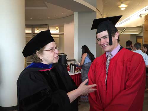
We attended two graduation ceremonies: the
Department of Classical Studies held a department ceremony for the 20
or so students graduating. Faculty members took turns speaking about
each student. The Department Chair, Dr. Anne Vasaly (with Griffin on
left), described
Griffin’s experiences since transferring to BU for his last two years
(he transfered from Wake Forest) and praised his academic abilities (he
graduated summa cum laude with
a major in Ancient Greek and Latin). She is also the person who
recommended him for the study program in Rome last year. There was a
reception after the ceremony for students and family and faculty. It
was a memorable experience that few university students have.
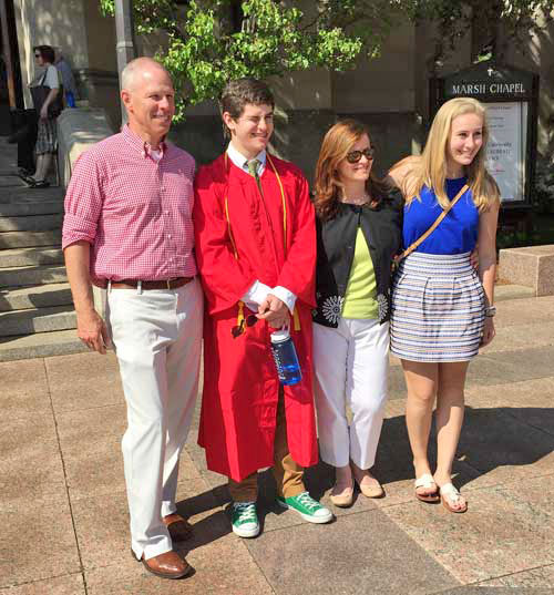
Two days later BU held its all-university ceremony
for an audience of 25,000 family and friends of the thousands of
students representing all the colleges and departments. As was true in
Hughes’s graduation in 1965, students filed into Nickerson Field—held
outside in beautiful weather—to witness the pomp and ceremony of famous
people receiving honorary degrees, (Meredith Vieira was an excellent
choice as the principle commencement speaker) and filed out within the
two-hour time frame. Very well organized. Post commencement family
photos were taken in front of Marsh Chapel. (Griff with Dan, Debra, and
Julia on right)
Monday morning after the Sunday graduation, Griffin
was up and off to work for the Massachusetts Department of Conservation
and Recreation, proof that a degree in Classical Studies can lead
directly to a job, though how his years of studying Latin and Ancient
Greek languages and history, including a semester of study in Rome, put
him on the fast track for a state government position is not entirely
clear. (In fact, his responsibilities in the position were, when we
were there, not entirely clarified). However, it is clear to us, proud
grandparents that we are, that his college career taught him to write
clearly, think critically, and communicate effectively. Plus, he could
always go back to Rome and lead English-speaking tours.
II. ON THE WAY
TO NOVA SCOTIA
About 40 years ago or more, we took an extended
family road trip through Ontario, Quebec, the Gaspé, Prince Edward
Island,and New Brunswick’s Bay of Fundy. We towed a tent trailer and
camped along the way. Time prevented us from including Nova Scotia on
our itinerary, but we talked about coming back some time and visiting
there, and maybe even Newfoundland and Labrador. This was the summer to
make that return trip.
•Boothbay Harbor, Maine
We left the Milton and drove up the coast through
Portsmouth, NH, Portland, ME and then on US 1 along the Maine coast to
our first nights stop in the Boothbay Harbor area. We chose Gray
Homestead Oceanfront Camping in Southport for the oceanfront location.
However, we made a careless selection: the road into the campground was
torturous and under construction, our site did not offer an ocean view,
it was nearly impossible to level the rig, the trees were dense as were
the insects. What a dreary, dumpy place.
Back on US 1 in the morning to Bangor, we then drove
east to Calais via State Highway 9, shorter in miles than going north
to Houlton, but longer due to road conditions and small towns to drive
through. However, we crossed into New Brunswick and found an unexpected
nugget in the charming village of St Andrews and a lovely campground,
Island View Campground
in Bayside, a few miles from St Andrews where we
could really see the ocean. In fact, we camped right next to it.
•St Andrews, New Brunswick
The village of St Andrews is one of
Canada’s
outstanding historic villages, packed with 19th century houses and
buildings (some of which were floated up the coast from Castine, ME on
barges); the remarkable Algonquin Hotel, museums, an aquarium, public
garden, nature center, galleries and other gift shops. The woman at the
visitor’s center was knowledgeable and enthusiastic about her town and
provided us with a map and suggested walking tour. We would love to go
back and could easily spend several days exploring.
III.
NOVA SCOTIA
We left St Andrews, picked up Highway 1 through
Saint John, Moncton, crossed into Nova Scotia (there is an excellent
Welcome Center at Amherst) through Springhill (home of singer Anne
Murray and site of the “Big
Bump” in 1958 in the Cumberland Mine, one
of the country’s great coal mining disasters), Truro, and finally to
Herring Cove, a suburb of Halifax, where we were welcomed by Gary
Redding and Linda Gardner with whom we made friends at Desert Trails in
Tucson. We parked in their driveway, plugged in the rig, and spent the
next three days enjoying their company, especially Gary’s cooking, and
seeing the sites in the area.
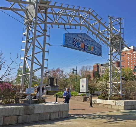
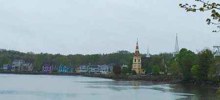
A. DOWNTOWN HALIFAX
Halifax
was established by the forceful invasion of
British forces and settlers in 1749 who ousted the Mi’kmaq,
Acadians,
and French who lived there. Edward Cornwallis promptly built one of the
prominent features of the city, The Citadel,
as a fortress to defend
the few imported British settlers and soldiers. This imposing
fortification is a destination for many tourists. There is much more to
see and do in the bustling city: the new public library is beautiful
and centrally located; the waterfront is a pedestrian-friendly
smorgasbord of shops, restaurants, and bars; the Maritime Museum of the
Atlantic (worth the entrance fee); the 265-year-old Farmers’
Market
(dreary and lifeless the morning we were there); next door is the
Canadian Museum of Immigration. Human and automobile traffic was
bustling—people in a hurry to get someplace and do things. There are
many websites and tourist centers that can suggest how you might spend
a day in the city, but one day is enough, at least for us. There is so
much to see out of town along the southern coast for us to spend more
than a single day in the city.
B. SOUTH SHORE VILLAGES
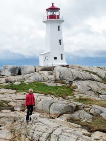 •Peggy’s
Cove
•Peggy’s
Cove
Twenty-six scenic miles down Route 3 from downtown
Halifax is said to be one of the most photographed fishing villages in
the Maritimes. On the edge of Saint Margaret’s Bay (named by Champlain
after his mother says one legend) are a scattering of older houses, the
much-photographed Peggy’s
Point Lighthouse, and about 650 residents who
are likely never there at the same time. The day we visited the weather
changed several times, going from rain, to drizzle, to hail, to
sunshine, and always windy. We were happy to find great chowder at the
Sou’wester Restaurant
where we sat for lunch in the warmth of the
building and watched the rain and hail plow against the windows
overlooking the lighthouse and cove.
•Terance Bay and Prospect
Just a few miles away on another point of land
sticking out into the ocean are the fishing villages of Terence Bay
and, a little farther on, Prospect, the less notable of the two. Skip
it and instead spend time in Terance
Bay, site of the several
shipwrecks, notably the RMS Atlantic
disaster that killed 535 people in 1873. The small, but well
organized
museum has historical documents and photographs that tell the story of
the wreck and of the heroic efforts of the residents who saved 371 men
from the ship. All 156 women passengers perished and all but one of the
189 children were lost. (Could this have prompted the motto of the sea:
“Women and children first”?) It is quite a story and the museum is well
worth the visit.
Just down the hill on the shore is the site of the
mass grave for the bodies brought up by divers from the wreckage. There
are separate monuments at the Terance Bay Anglican Church and at the
Catholic cemetery.
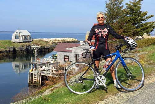
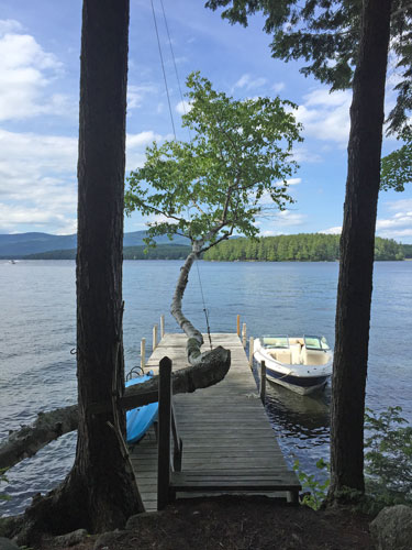
•Hubbards
A little further south on the Aspotogan Peninsula is
the former fishing village of Hubbards,
now a popular tourist
destination. It is located on Highway 103 and has an easy entry to the
rails to trails bike path that parallels the coastline. We returned
with our bikes and rode around the scenic Aspotogan Peninsula to
Blandford (See Judy below with bike at Blandford). Before we left the
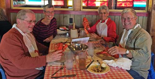
Halifax area, we returned to Hubbards to
treat our hosts to a classic lobster dinner at the famous Shore Club in
Hubbards: a whole lobster plus an unlimited salad bar, unlimited
servings of mussels, potato salad, and desert (and a price you won’t
choke on).
•East River
Located officially in Hubbards, but really on a wide
place in the road along Route 3 known as East River on maps, is the
award-winning Trellis Café.
This modest establishment serves inventive
and freshly made pastries, pasta and seafood dishes. However, Hughes
thought their coffee was so outstanding that he asked the waitress what
it was. She returned with a package of organic Sumatra beans, dark
roasted, that they purchase from Costco in Halifax. In fact, it may be
a Kirkland/Costco brand. We looked for it at our Costco here at home
but couldn’t find any. It was the very best coffee of the entire trip.
It’s worth the half hour drive from Halifax to enjoy a cup.
•Chester
Next in the string of coastal villages, Chester
seems to be an up and coming destination for trendy art galleries in a
quiet, easily accessible location that may be best known for The
Fo’c’sle, an old-world style pub with a good beer selection and
tasty
chowder.
•Mahone Bay
Another picture post card village was founded on
shipbuilding, principally wooden boats which are celebrated each year
by a wooden boat festival. Today Mahone
Bay welcomes tourists from all
over who come to walk the streets, visit interesting shops (especially,
the three stories of fabrics, quilts, rugs, clothing, and other items
for the home at Suttles and Seawinds);
watch pewter jewelry and gifts
being made at the Amos Pewter
store; or eat in one of the trendy cafes
and restaurants along the main street. As we approached the town we
noticed the three churches, Anglican, Lutheran, and Trinity United that
rise above the bay. Like the lighthouse at Peggy’s Cove, these three
churches are frequently photographed for calendars and postcards. If we
ever go back, we would be sure to revisit Jo-Ann’s Deli Market and Bake
Shop at the crossroad of Edgewater and Main Street.
•Lunenburg
We saved this historic town for our first stop upon
leaving Halifax. We thought there would be lots to see and do.
Lunenburg was
designated a World Heritage Site by UNESCO to protect its
unique architecture; it is also considered to be the best example of
planned British colonial center in Canada. Like Halifax, the British
unilaterally established Lunenburg to displace the indigenous Mi’kmaq
and the earlier French Catholic settlers and develop a protestant
colony. By 1753, they succeeded.
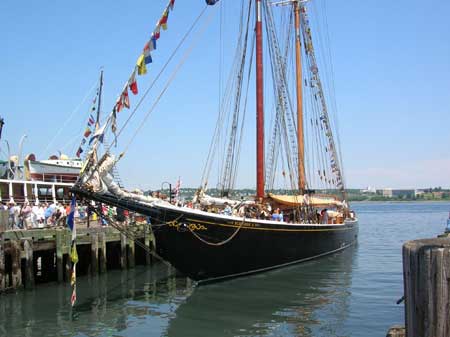
Today Lunenburg is known as a shipbuilding center
and the home port of Bluenose
II, a replica of the famous fishing and
iconic racing schooner of the 1930s which is portrayed on the Canadian
dime and, recently, on Nova Scotia license plates.
The town’s Board of Trade runs a visitor’s center
and an attractive campground
just a short walk above the center of
town. The walk to town took us by many carefully maintained historic
homes. As we wandered through the town we sampled some of the brandies
and liqueurs at the Ironworks
Distillery, visited the Fisheries Museum
of the Atlantic, photographed the magnificent St. John’s Anglican
Church, went by dozens of studios and galleries. The Lunenburg
Academy
(a public school) building is especially dramatic, standing on “Gallows
Hill” overlooking the town since 1895. It is the only intact 19th
century academy in Nova Scotia. The Bluenose II is docked at the
colorful waterfront. Of the dozens of places to eat in the area, we
were quite pleased to choose the Salt Shaker Deli, a block off the
water where seafood and pizza are popular, the beers are cold, and the
chowder is excellent.
[Note: We saw how
World Heritage status dramatically changed—we think for the worse—the
Italian hill town of San Gimignano. Thousands of tourists daily may be
good for businesses, but mobs destroy/change the charm and soul of the
town forever. It could happen
to Lunenburg, so hurry and visit before it changes.]
C. BAY OF FUNDY AND ANNAPOLIS
VALLEY
•Kejimkujik
National Park
North and inland from Lunenburg the landscape turned
to farming and lumbering. There were few vistas like those we had
enjoyed along the coast. Forests blocked much of the scenery except for
the occasional farming fields. We passed many piles of stacked firewood
by the roadside: fuel for a family’s winter heat.
Wiggling through miles of small towns and back
roads, we reached one of two national parks in Nova Scotia, often
referred to as “Keji” by visitors and locals alike. The inland section
covers 156 square miles of lakes and forested upland plain. Most of the
park is accessible only by foot or canoe, but the one campground is
located on the shore of Kejimkujik Lake, the largest lake in the park,
a good place to fish we were told, as well as to enjoy the quiet of the
forest and hear loons at night. The park is home to moose, deer, and
the occasional bear. Because the park is designated as a “Dark Sky
Preserve,” we might have had a spectacular view of the night sky except
for the persistent clouds. We walked part of the trail that follows the
shore from the campground. Camping facilities were electricity only and
clean bathrooms.
[Note: There is a
second, much smaller section of the park called Kejimkujik
Seaside, which we did
not visit. It
is an area of sandy beaches and wetlands habitat for endangered bird
off Highway 103 near Port Moulton.]
•Bay of Fundy
The Bay is located between Nova Scotia and New
Brunswick to the north, and is best known for the dramatic tidal
changes that occur daily, rugged coastlines, whale watching (in
season), and lighthouses stretching 117 miles from Westport to Cape
Split. This coast is not possible to access by car everywhere; there
are only occasional sections of (very rough) roads where small fishing
villages or lighthouses still stand.
We drove north from Kejimkujik to Annapolis Royal
(smaller and less grand than the name lead us to believe), and
continued north to reach the coast at Parker’s Cove. We followed the
coastline east to the 100-year old Hampton Lighthouse,
still in good
condition supported by a private organization, though the trees have
grown so that they obscure much of the light from the water.
[Note: It was on
the short drive along the coast that we encountered the first of many
amazingly rough roads across the province which appear to have been
ignored for decades by Nova Scotia’s highway department. We bounced
along dodging potholes at much slower speeds than planned, and our
towed car suffered as well. If you drive off the main highways in Nova
Scotia, beware!]
•Annapolis Valley
This narrow strip of land of lush farms and
vineyards lies between the
coast of the Bay of Fundy and the forests to the south. The valley is
noted for its fruits and wines, and the town of Kentville celebrates
this with an annual “Apple Blossom Festival.” Since we it is held in
May, we put it on our itinerary and looked forward to the excitement.
We were disappointed to learn that the festival highlights included
music provided by local rock bands, rubber duck races, the crowning of
the festival queen, a tractor pull, and a pancake breakfast. We moved
on.
In our continuing search for interesting
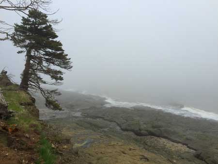
lighthouses, we drove north of Kentville to Cape
Split, a dramatic
point of land reached only by a two-hour hike from road’s end. By the
time we reached the trailhead at the end of the road (see photo on
right), the fog had made
safe driving nearly impossible and no pictures were possible. The
campground at Blomidon
Provincial Park to the south was equally fogged
in, though in fair weather the views and beaches are probably very
attractive. We opted instead for a site at Look-off
Campground, which
was due to open the next day. They took us in anyway.
D. EASTERN SHORE
We returned to the highway (Trans-Canada 1) near
Kentville and drove toward Halifax and picked up Highway 7 heading east
along the coast. While not as scenic as the South Shore villages, we
found plenty of decent weather and places to stop and explore this part
of the province.
•Lawrencetown Beach
We took advantage of a rare day of mostly sunny blue
skies
and fair weather to go to the beach!
Lawrenceteown, one of the last areas the British
invaded to oust the Acadians and Mi’kmaq in their quest to conquer the
province, strongly resisted the British takeover for several years. In
1754, at the start of the French and Indian War, the Mi’kmaq and French
attacked the British soldiers and settlers and eventually drove them to
Halifax. The area grew in the 1800s due to good farming and lumbering
opportunities and, for a short time, to gold mining a few miles north
at Mineville. Today Lawrencetown is home to a provincial beach park
that is a popular destination for surfers (we saw three even on a windy
day with little surf) and those seeking good beach conditions. The
2,500 residents have an easy commute to Dartmouth and
Halifax.
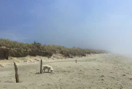
We found walking the beach a wonderful way to slow
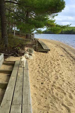
down from all the driving and relax under blue skies. Lucy especially
enjoyed the stop. She ran across the sand, dipped her paws in the
Atlantic, and sniffed out sand fleas and chased birds. We watched the
fog come in and go out. We all
appreciated the stop.
•Clam
Harbour Beach
We’re not sure how much goes on in this small rural
community, but the beach is apparently one of the best and most popular
in Nova Scotia. The mile of fine clean white sand makes it perfect for
the annual Clam Harbour Beach Sandcastle Competition held in August
(“rain or shine”), which is now in its 36th year. Provincial Park
supervises the beach and surrounding property.
The area was deserted and, though against the rules,
we let Lucy have the run of the place while we walked slowly with our
heads down search for beach glass and precious stones.
•Sherbrooke
We drove along Highway 7, nicknamed “The Seacoast
Trail,” without stopping at sites and towns and attractions we would
explore if time were not our constant constraint: the Acadian House
Museum at Chezzetcook, the Icelandic settlement near Markland, gold
mining history at Moose River and Goldenville; and many other sites we
have learned about.
We really did not do justice with all that the town
of Sherbrooke has to offer, particularly Sherbrooke Village,
a living
museum depicting life in the late 1800s. Next trip. We had our sights
set on maximizing our time on Cape Breton Island. So we turned north at
Sherbrooke and spent the night at an overrated campground near Linwood,
getting us close to Port Hastings where we would cross over to the Cape
Breton in the morning.
E. CAPE BRETON ISLAND
•The Ceilidh Trail
While there is much scenic beauty on Cape Breton Island, an
important feature of this part of Nova Scotia is the music that seems
to be present in many areas of Cape Breton. The road from Port Hastings
to Margaree Harbour has been labeled the Ceilidh
(“KAY-lee”) Trail to
emphasize the presence of this music and the culture from which it
originates.
[Note: The area
around Cheticamp, just 14 miles north of Margaree Harbour at the end of
the Ceilidh Trail, has a strong Acadian tradition and that music is
often heard and performed. Acadian French is heard often among the
residents of the area, many of who also fly the Acadian flag. It
was here,
perhaps, that we began to appreciate how patriot and proud Canadians
are of their country. We saw Canadian flags everywhere— in cities,
villages, isolated farms. In addition, flag representing the province,
Cape Breton, and Acadians flew alongside each other. We see flags in
the USA at post offices and government buildings, and at homes, but
usually just around holidays.]
≈
We camped at Port Hood, about halfway between
Judique, home of the Celtic Music Interpretive Centre Society, and
Mabou, home of the Rankin Family and the Red Shoe Pub, (see photo above)
where we spent a
memorable evening enjoying Celtic music by fiddler Howie MacDonald with
Mac Morin on the piano. There was unexpected spoon playing by local
Jerry Deveau (spelling?) and Celtic dancing by many of the
patrons.
The night before, we attended a remarkableevening of
Celtic music and dance by area young people at the An Drochaid Museum next door
to
the Red Shoe. The young performers (ages 6–17?) presented a program
entirely in Gaelic. In the audience, and among the young performers
were many relatives of the Rankins, Natalie MacMaster and her uncle
Buddy MacMaster, and members of the Beaton and MacDonald families, area
musicians who support the programs of the museum. We were invited to a
community ceilidh to be held following the Red Shoe program at a sport
arena outside of town. But it would start so late and go until the last
dancer dropped that we declined. We should have gone, but.....
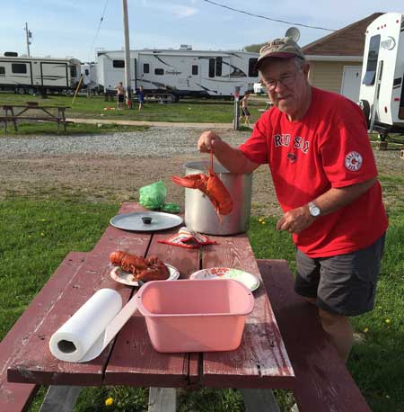
We drove one afternoon to Mabou
Harbour to
photograph the lighthouse. While we were there, a lobster fisherman was
returning with his day’s catch: several 100-pound crates were lifted
off and taken into the dockside lobster shed housing storage tanks.
Judy asked the captain if he sold them right off the boat. He said of
course. So that evening we borrowed a lobster pot from the campground
manager and steamed the two good-sized fresh-from-the-sea lobsters, not
our first ones of the trip but certainly the freshest. “Kickin’ fresh,”
some say.
We spent part of a day simply driving in the area of
Mabou, inland around Lake Ainslie, and the coastal villages of
Inverness, Dunvegan, and Margaree Harbour. We stopped at the Glenora
Distillery that produces North America’s first and Canada’s only single
malt whiskey in hopes of a tour of the distillery, a tasting, and a
performance of Celtic music as advertised. We were disappointed on all
counts for vague reasons that had something to do with being too early
in the season.
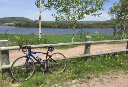
However, the next time we were in the neighborhood,
we definitely would spend time bicycling on the Celtic
Shores Coastal
Trail, (see photo on right) a smooth gravel path that hugs the west
coast. Our weather
at the time was not
encouraging and the tires on our road bikes were probably not
appropriate. Next time we’ll plan differently.
•Cheticamp
Cheticamp is
the gateway to
Cape Breton Highlands
National Park, the centerpiece of the Island and a magnet for
campers,
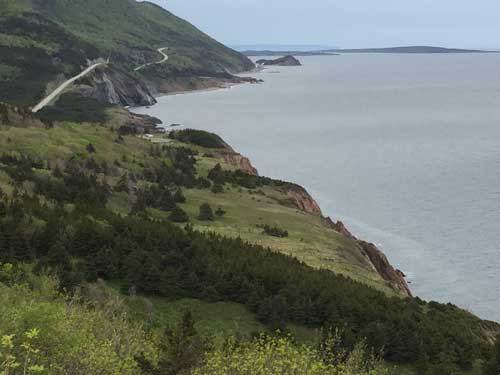
hikers, cyclists, and motorcycles from all over the world. The Cabot
Trail, 185 miles from Cheticamp to Baddeck, named by Lonely Planet as one of the best
road trips in the world, hugs the sides of the mountains and offers
spectacular ocean views on both the east and west coasts of the
island.
We camped one night the Cheticamp Campground just
inside the National Park. We shopped in Cheticamp, Hughes got a haircut
by Jimmy the Barber and Judy got her hair done at Wayne’s Beauty Salon.
Wayne Aucoin was so good that Judy offered to bring him home with us,
but he declined. Instead, he asked to be her friend on Facebook. Hughes
discovered Charlie’s Country Music, an unremarkable lookling store that
also sells groceries and souvenirs. But their variety and quality of
Celtic music CDs was the best he found on the whole trip. Our half
dozen new CDs were hard to select from the hundreds on hand.
We had dinner at Le
Gabriel Restaurant and Lounge
for several reasons: it came recommended for its food (we enjoyed a
full lobster dinner that didn’t hurt the wallet too much); there was
music—a Celtic fiddler with keyboard accompaniment; and the well- known
Doryman Pub and Grill was only
serving pub food without any music on
that night. We’ll come back to the Doryman another trip.
After dinner we took Wayne’s suggestion and went to
a local jam session at a hall on the outskirts of town. We arrived
after the session began, paid our modest entry fee, and listened to
about 20 guys and one woman take turns playing and singing American
country and western tunes with everyone doing backup. It was a strange
evening of music compared to what we had been used to up until then. We
learned the group meets informally once a week and serves, as one
fellow said, as therapy. We did stay until everyone had played, but not
when they were finished for the evening. BTW, Wayne did not show up as
Judy thought he might.
•Cape Breton NP and The Cabot
Trail
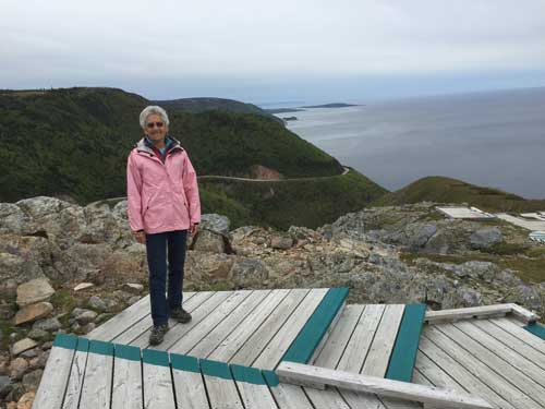
We took advantage of the one day without rain and
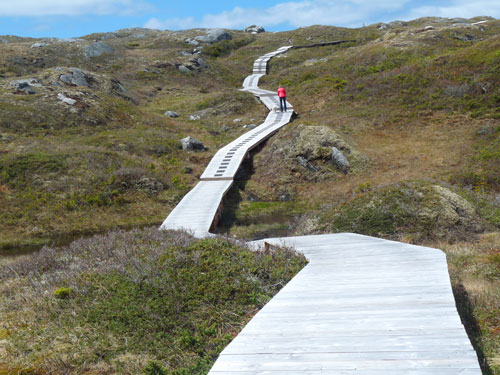
did several hikes in the park, beginning with the best-known and most
photographed trail, Skyline.
This 7.5 km (4.5 miles) takes hikers
through moose country (warnings everywhere, but not a moose in sight.)
The view along the way are what we might expect hiking through the
national forest across the road from us, but the last quarter of a mile
is a boardwalk leading to a headland cliff and spectacular views of the
ocean, Cabot Trail, and whales (in season). It is easy to see why this
is a very popular hike: great views, 400 ft elevation difference, 2-3
hour round trip, and easy to moderately difficult. Park rangers also
lead a “Skyline Sunset Hike” Monday through Friday during the summer
months.
We filled in some extra time with a short self-
guided trail, Le Butterau, (“small hill”) a one-mile loop with good
ocean and shore views and a chance to explore the remains of homes of
pioneers who once lived and farmed in this area.
It was raining hard the day we left to drive across
the top of Cabot Trail to Ingonish. (The photo below was taken the
afternoon before we left.) Checking at the ranger station
about road conditions, we were warned that the winds were blowing at
100 kph (+60 mph), which would make for a bouncy trip. We unhooked the
car from the RV and drove separately battling high winds all the way to
Ingonish where we planned to spend a night. Ordinarily the 65 miles
takes about two hours to drive. We took much longer and saw little of
the scenery, just the few hundred feet of the road ahead.
The Park
campground at Ingonish on the east side of the island was quagmire
and
appeared to be open when we pulled in, but with only a couple of other
rigs there we weren’t sure. However, we needed to stop and we did,
waiting for the rains to let up. We had planned to make our getaway for
drier weather in the morning, but the day broke sunny and warm and the
campground looked rather inviting. We walked through the grounds, which
covered quite a few acres and down to the shore where the surf was
bashing the rocks and throwing waves quite high. We checked the weather
forecast and decided to spend the day in the area. We looked for the
Seagull Restaurant just down the road (friends had raved about their
lobster chowder), but they were closed, getting ready for opening in a
week or two. The Main
Street Restaurant and Bakery was a satisfactory
substitute, though we would like to have tried the Seagull for
comparison.
At nearby Ingonish Beach the luxurious Keltic Lodge
is the starting point for a scenic hike on the Middle
Head Trail that
follows a narrow peninsula to headland cliffs overlooking the ocean
(see photo abaove). We
had hoped to see whales and eagles, but instead watched local fishermen
slowly ply the shoreline checking their traps. The views of Ingonish
Island and Cape Smokey were clear on this rare sunny morning.
That evening we drove to the lodge at Ski Cape
Smokey, a non-profit ski facility in this unlikely spot on the
Atlantic. Theunusually heavy snow this past winter made it possible to
have a four-month ski season. We arrived earlier than advertised and
spent a good hour chatting with the singer, Cyril MacPhee, during his
sound check about singers he had performed with (Stan Rogers, Natalie
MacMaster, John Prine, et al.).
Before we left the Cabot Trail and while there was a
break in the clouds, I drove Judy and her bike back up to near the top
of the Cabot Trail so she could ride at least a part of this remarkable
road and get some bragging rights.
•Baddeck and the
Alexander Graham Bell
National Historic Site
Baddeck
is the popular town near the southern point
of the Park that is home to an outstanding museum dedicated to this
remarkable man and his equally remarkable wife, Mable Hubbard Bell. The
museum, through photographs and artifacts, shows the range of his
genius; more than “simply” inventing the telephone, he taught the deaf
and created an alphabet that taught them to speak, (Mabel herself was
deaf), he successful experimented with kites and airplanes (both
designed to carry people) and hydrofoil crafts. We learned so much from
our docent who guided us through the museum with enthusiasm and
detailed insights. It is a must-see stop for all visitors.
St. Michael’s Parish Hall in Baddeck hosts
ceilidhs
every night through July and August featuring many Cape Breton fiddlers
and singers. Like so many events, we came too early.
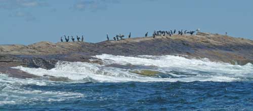
•Bird Island
We left Baddeck for the Mountain Vista Seaside
Campground in Big Bras d’Or (“bra door”). We chose it for its
promise
of a scenic location and comfortable facilities. What we did not
appreciate beforehand was that it was also the home of Bird Island Boat
Tours, which we signed up for that next day. Captain Vince van
Schaick’s family has operated these tours to the two islands about six
miles offshore for 40 years and he has a wealth of knowledge about the
area seabirds (puffins, arctic terns, gulls, kittiwakes, and at least a
dozen others). His narration throughout the tour held our interest and
clarified what we saw during the three-hour tour. Fortunately we had
excellent weather for the morning.
•Cape Breton Miners’ Museum
The weather began to turn on us as we left for the
Arm of Gold Campground in
Little Bras d’Dor overlooking Lake Bra d’Dor.
The campground was excellent for us: it located near the Newfoundland
Ferry Terminal in North Sydney just three miles away (we were leaving
the next day); the campground had acres of grass, walking trails, flat
sites, a fair price, and they would store our car while we were in
Newfoundland. As the rains came, we decided to take advantage of the
afternoon to visit the Cape
Breton Miners’ Museum in Glace Bay.
The museum’s Ocean
Deeps Colliery tour succeeded in
reproducing the feeling of an underground mine (created to replicate a
working mine): low ceilings, seeping water, a coal seam, equipment, dim
lighting, etc.). Our guide, Sheldon McNeil a miner for 29 years, was
informative, humorous at times, and made the experience of underground
mining come alive. The musefishiing fishing vikinum displays were
interesting, but the tour
was the highlight and not to be missed. On our next visit we would hope
to hear the “Men of the Deeps,”
a world famous choir made up of working
and retired area miners.
We had made reservations on line for the Marine
Atlantic ferry and arrived two hours before departure as requested. We
joined a hundred or so cars, motorcycles, RVs, and trucks ready to
drive into the space on the third deck of the ferry. Pets were required
to either stay in the owner’s vehicle below deck during the 7-hour
passage, or for a small fee be kept in a traveling crate stored in a
special area in the passenger area. We felt Lucy would be more at home
in our motorhome with familiar smells and bedding around her. She made
the trip both ways without issue.
[Note: Marine
Atlantic operates two ferries a day from North Sydney to Port aux
Basques: one in the morning and one evening/overnight ferry (our choice
next time). The price is based upon the length of the vehicle,
including those towed, and the number and ages of travelers. For a few
dollars more private cabins are available. Our round-trip cost was
under $500 Canadian dollars, or less than US$400 with the exchange rate
at that time. We didn't really need reservations, but this was before
"the season."]
IV. NEWFOUNDLAND 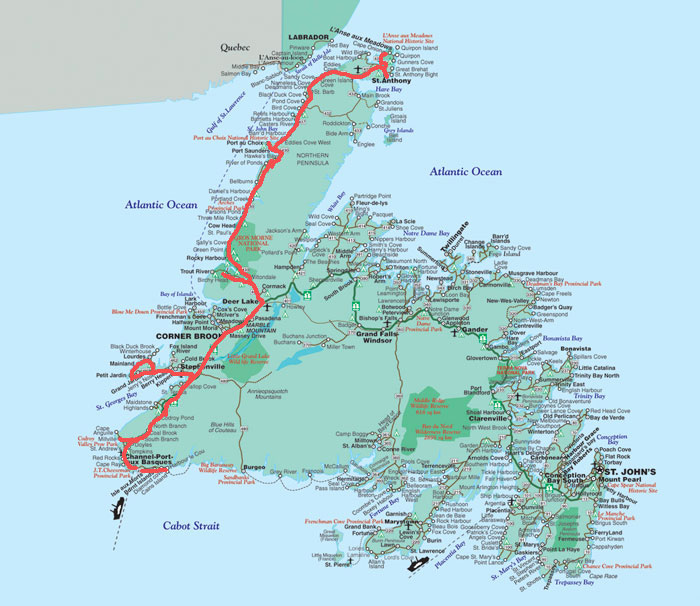
Our trip was uneventful and smooth. And a bit dull:
no whales to see, a few dolphins, lots of time to read, snooze, or
snack. TVs and computers were available, but all in all we had seven
hours of quiet time. We landed at Port aux
Basques (Yes, Basque
settlers were there first along with the French, Mi’kmaq, and a few
Portuguese.) and drove directly to the well advertised and recommended
Grand Codroy Campground at
Doyles a half hour up Highway 408, the only
road north. Before dinner we took a short ride around the villages on
the Codroy
Valley, stopped at the beach of the Codroy Provincial Park,
and returned at dark to the campground where we ate, checked the
upcoming weather, and made plans for the next two days.
Our general aim was to explore only the west coast
of Newfoundland all the way to the northern most area around St
Anthony. We could either go village to village from south to north and
return quickly in time to board the return ferry in a week. Or make a
direct run to the St Anthony and return village to village on the way
back to the Port aux Basque. In the end, the weather was the decider:
two days of wet weather was predicted for the west coast, so we planned
to make a direct “run” to St Anthony (Follow the red line). This would
also put us there for
the upcoming Iceberg Festival. It turned out to be an excellent
decision. We drove through rain and fog the next day, with windshield
wipers going constantly, to a small campground at Hawk’s Bay near Port
au Choix that night. We arrived just after noon in St Anthony in a
light drizzle. We covered 462 miles in the day and a half, pretty good
time considering the rainy weather and the often rough roads.
On the way, the brake warning light appeared on the
instrument panel urging us to get the problem fixed right way
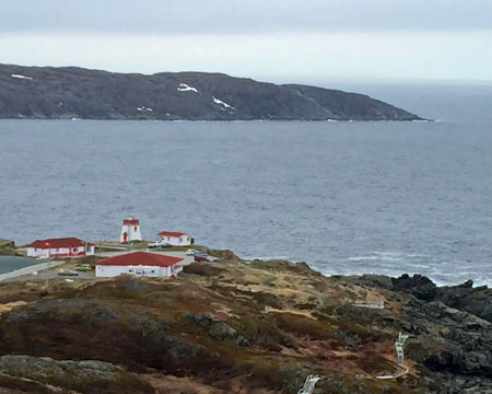
•St Anthony
This town of 2,500 folks seemed like a metropolis
compared to most of the other towns we passed through. There were ample
stores for most goods, basic services, an outstanding regional
hospital, civic and service organizations, one car dealer (Chevrolet),
and what we think was a good car/truck repair shop: Maurice’s Service
Center. They took us in immediately, checked the brake situation, and
said they could replace the brake linings and rotors—if they could get
the parts. After calling distributors all over Newfoundland and
off-island, the soonest they could get the necessary parts would be 3-5
days (over the weekend). Too late for us. We were in the position to
have to carefully limp along until we got back to the ferry in six
days.
[Note: We called
two repair shops in North Sydney (Nova Scotia) where the ferry lands to
see who could do the repair when we returned. Ralph Ivey, owner of
Ralph Ivey’s Auto Repair assured us he would have the parts for us the
day after we arrived in North Sydney
and would get us on our way the same day.]
St Anthony provided lots of wonderful memories for
us, and we met we folks who were very welcoming and friendly. Our first
stop (after having the brakes checked) was to Fishing Point
at the
eastern end of town, where we climbed the challenging Daredevil Trail
that overlooks Fishing Point on the eastern edge of town: 476 steps to
an overlook atop a mountain with great views of the town and the bay.
We also walked part of the Iceberg Alley Trail that leads back toward
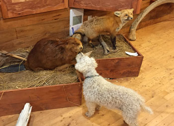
town. We met the women who run the Fishing Point Emporium
and
Interpretation Centre where Judy found a lovely labradorite
pendant,
Hughes found some additional CDs of Newfoundland music, and Lucy came
nose to nose with a beaver, fox, and polar bear (on exhibit). The women
also treated us to some homemade berry ice cream. 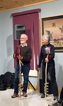
In the evening, we went to the Grenfell Kitchen
Party. We enjoyed a traditional Newfoundland dinner that included fish
cakes, toutons served with molasses or bakeapple cloudberry jam, which
we washed down with 15,000-year-old bottled 80 Degrees North Iceberg
Water. After dinner the ceilidh was a lively couple of hours of
traditional music, accompanied by ugly stick
players from the audience,
and at least one Celtic dancer also from the audience. We had a chance
to meet with some of the entertainers and other guests, including two
charming women, Magda and Irene and from Ontario, the Head of Surgery
at the Grenfell Hospital, and others from the town. It was a splendid
evening, the kind visitors look forward to. We enjoyed every bit of it.
•L’Anse aux Meadows
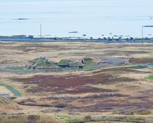 The following morning, we drove about 30 miles to
the northern tip of the island to learn about L’Anse aux Meadows, a
World Heritage Site, the only known Viking village in North America and
earliest European settlement in the Western Hemisphere. Around the year
1,000 C.E., Leif Eriksson persuaded 60–90 Norse adventurers to
establish a settlement within sight of Labrador near the entrance to
the Strait of Belle Isle. What its name was we don’t know for sure, but
we know life was difficult due to weather and relatively unwelcoming
Aboriginal peoples, ancestors of Innu, Beothuk, and Mi’kmaq who greatly
outnumbered the Europeans. The settlement was abandoned within a few
years.
The following morning, we drove about 30 miles to
the northern tip of the island to learn about L’Anse aux Meadows, a
World Heritage Site, the only known Viking village in North America and
earliest European settlement in the Western Hemisphere. Around the year
1,000 C.E., Leif Eriksson persuaded 60–90 Norse adventurers to
establish a settlement within sight of Labrador near the entrance to
the Strait of Belle Isle. What its name was we don’t know for sure, but
we know life was difficult due to weather and relatively unwelcoming
Aboriginal peoples, ancestors of Innu, Beothuk, and Mi’kmaq who greatly
outnumbered the Europeans. The settlement was abandoned within a few
years.
Today, the settlement that was once composed of
eight houses and four workhouses sits in what is today a treeless area
that runs down to the tiny coastal settlement of Straitsview. Where a
thousand years ago trees for lumber and trade once grew, low grasses
now have overgrown the bumps in the ground that outline where Viking
buildings once stood. The reconstructed buildings are made from sod,
small and sturdy, and are home to the re-enactors who are happy to
describe what their lives might have been like 1,000 years ago. The
visit was very educational and worth the drive to the end of the road.
We spent the afternoon with Northland Discovery Boat
Tours for an amazing tour of the icebergs not very far offshore in
“Iceberg Alley.” Our guide had studied icebergs and had visited
Greenland to see where the icebergs that float by St Anthony
originated. We learned about marine wildlife and culture as well as
everything we didn’t know about icebergs. Again, we were too early in
the season to see whales. We got some terrific up-close photos of these
giant chunks of ice.
•Port au Choix 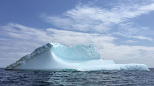
The drive to Port au Choix
took us by as many as
twenty small fishing villages, most with about 100 residents, some with
schools, most with a church, all with houses that looked in good
condition thanks to a Provincial Home Repair Program designed to assist
low income residents to make improvements to their heating,
electricity, plumbing, windows, siding, roofing, etc. The result is a
string of small coastal villages with small homes that looked “spruced
up” all at about the same time and in the same manner. For example, it
looks like almost everyone opted for a front door with an etched glass
insert. White is the overwhelming choice for vinyl or aluminum
siding.
The town of Port au Choix (Port of Choice) is touted
as the fishing capital of Western Newfoundland. A large fishing fleet
is present, a modern shrimp processing plant, government offices, and
other services. In addition the town of about 1,000 is a national
historic site rich in archeological finds that are evidence of the
earliest aboriginal settlements. We had an outstanding
fish dinner at the Anchor
Cafe: halibut, cod, and shrimp. And they served Iceberg
Beer.
[Hughes considers
this finest beer he’s ever enjoyed. Iceberg Beer brewed by the Quidi
Vidi Brewery in St. John’s from “Newfoundland’s awe- inspiring
icebergs.” In an inquiry we made when we got home about where to
purchase more of the beer, Mitch Gilbert emailed from the brewing
company said they can’t fill the demand from Newfoundland, but they
hope to expand so “check back in a few months.”]
We camped on the beach that night at the Oceanside
RV Park, with sites facing the ocean and grass for tenters operated
by
the local Lions Club. What a view, what a sunset, what peace and quiet.
The fee was a modest $25 a night with showers and free internet. It is the place to camp on the west
coast.
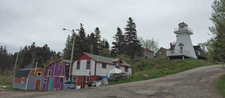
•Cow Head Lighthouse
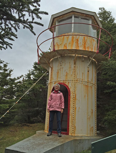
As we continued south, the weather became dry enough
to do some hiking. We turned off at Cow Head
where Magda and Irene said
they found an attractive B&B and a fishing village separated into
two parts: “Winterside” on the mainland and “Summerside” across a
natural isthmus called the “Sandbank.” This seasonal migration was a
tradition in many fishing villages throughout Newfoundland for
generations. We drove to the end of the road in the Summerside area and
hiked to the Cow Head Lighthouse, an 18-foot iron tower built in 1909.
Today, the exterior shows signs of rust and corrosion. Some of the
money from a government grant for improvements was used to erect a
small amphitheater at the start of the trail. A large meadow near the
lighthouse has been a picnic area for local residents.
•Gros
Morne National Park
This area of snowy mountains, clear lakes, and
unusual geological features is one of two National Parks in
Newfoundland (Terra Nova in the east is the other). We saw little of it
on our trip north because of weather, and we didn’t have much
improvement on the way back. One of the premier hikes is to the top of
the tablelands, an area where the earth’s mantle is exposed over a wide
area. The weather made the hike to the top less than desirable, though
we did explore this unique geology of the area along the trail at the
base of the mountains. Rain cancelled boat trips and a hike to Western
Brook Pond, something we had put at the top of our list. (If we return,
we’ll find a dry, clear day and make sure to experience this area.)
We found our way to Rocky Harbour, Norris Point, and
Woody Point (pictured here)that
surround Bonne
Bay, one of the most dramatically
scenic areas we have seen anywhere. These small fishing villages have
shifted their attention to attracting tourist for scenic boat rides,
good restaurants and pubs, and evening music programs. We spent the
evening in Norris Point’s Cat Stop
to hear Angus Stewart, a local
singer/guitar player. He was easy to listen to and we enjoyed the beer
and snacks. Angus’s wife was with him and she got talking with us. To
our surprise she urged us to leave early and get over to the Anchor Pub
in nearby Rocky Harbour to see the musical show featuring a popular
group called “Anchors Aweigh.” We were lucky to get two of the very
last tickets (a bus tour had made reservations beforehand). The guys
put on an entertaining show of traditional music and funny stories. It
turns out they are among the ten most popular groups in Newfoundland.
Our stay at the Gros Morne RV/Campground was comfortable and gave us
easy access to the southern sections of the Park.
•Stephenville and Cape St. George
We drove south, bypassing the “city” of Corner Brook
(population about 20,000 and the center of services and shopping on the
west coast) and headed for Stephenville, a small town (population about
7,000) with a most unexpected history. Until the mid-1800s this was a
small Acadian fishing village. Though the population grew slightly for
a hundred years, the area experienced a boom in 1940 when the US Army
constructed the Ernest Harmon Air Force Base. In 1966 the base was
closed and turned over to the provincial government. Stephenville
International Airport took over much of the facilities, and other
buildings are now used by the town for housing and recreation. The
abandoned runway looked like it might be a safe and acceptable place
for boondocking.
We spent most of our time driving around the very
scenic coastline of Port au Port Peninsula, going from one fishing
village to another. We stopped first to admire the imposing Our Lady Of
Mercy Church, the oldest wooden structure in the province and normally
open to the public. Not today.
Not far from the church was an unannounced trailhead
to a coastal trail that began at an antique dory that folks seem to
like to play in. Further along our drive we discovered another
unannounced trail that lead to a hidden (from the road) waterfall near
a fishing boat launch area with an easy trail nearby to catch good
ocean views.
The only major break in the landscape on Cape George
was a huge gravel quarry operated by Atlantic Minerals at Sheaves Cove.
The company owns or controls 16,000 acres on which it extracts chemical
grade calcium limestone and dolomite. The quarry looks very much like
an open pit mining operation one might see in the western US, and
stands in contrast to the farming and fishing countryside of the rest
of the peninsula. This past winter Atlantic Minerals was seeking
approval to expand their operations. Local folks are seeking relief
from the government to protect their water supply and wildlife. We
don’t know how the conflict has been or will be resolved.
•Cheeseman
Provincial Park
Judith Sutton, a friend from Newfoundland we met at
Desert Trails, described Cheeseman as one of her favorite places as a
child growing up in the area. She urged us to stay at least one night
to enjoy the beach and the scenery of the area. She was right: our
campsite was very comfortable with a great view, and the Smokey Cape
Walking/Fitness Trail is an easy mile walk to one of the best beaches
(we’ve heard) in Newfoundland. It’s where folks from the southern part
of the province come to get a tan and swim in the surf. Our weather was
generally dry and sunny, but chilly. We stayed two nights so we could
explore the small villages along the southern coast that were close to
the ferry at Port au Basques just a few miles away.
•South Coast Villages
The map says there are several villages from Port
aux Basques east to the end of the road 27 miles away. We found really
only four:
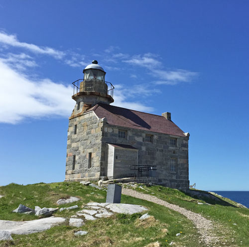
•At the end of the pavement east of Port Aux
Basques is the village of Rose Blanche,
a popular destination because of the unique lighthouse,
a fully
restored structure made from entirely from local granite. The interior
was restored in 1999 and it is one of the few lighthouses open to the
public to see how families lived there in the 19th century. The view of
the village and surrounding coast is worth the challenging drive over
rough pavement.
•Burnt Islands
is a picturesque fishing village of about 900 people, less than in the
peak years before the cod moratorium in 1992 that forced many to leave
in search of jobs elsewhere.
•Isle aux Morts,
like the other two villages, owes its existence to fishing as their
coves are well protected. The population at Isle aux Morts also
declined because of the moratorium on cod fishing, and the subsequent
closing of the fish plant and related jobs. However, this town
continues to draw a few visitors who are attracted by two fine walking
trails: the Boat Cove Trail and, the one we walked, the self-guided
Harvey Trail named in honor
of George Harvey and his daughter who
bravely and successfully rescued sailors from sinking ships. We found
wonderful views of the town and bay from different locations on the
trail.
[Note: For a
variety of reasons, we did little geocaching on the trip. However, on
our last day in Newfoundland along the Harvey Trail we found
the only two geocaches we
attempted, except for a DNF at a park in Halifax with Gary and Linda,
who returned after we left and found the one the four of usdid not find
earlier.]
 •There aren’t many folks still living in Margaree, but there is an excellent
restaurant located there: the Seashore
Restaurant. You can’t miss it in
this small village just a short 7-minute drive from Port aux Basque and
the ferry to Nova Scotia. The chowder was made fresh as were the rolls,
still hot from the oven. The service was excellent and personable, and
the fish very nicely done. We hope it continues to succeed and we
highly recommend the short trip to Margaree for those stuck in Port aux
Basque and want an excellent meal with a great view.
•There aren’t many folks still living in Margaree, but there is an excellent
restaurant located there: the Seashore
Restaurant. You can’t miss it in
this small village just a short 7-minute drive from Port aux Basque and
the ferry to Nova Scotia. The chowder was made fresh as were the rolls,
still hot from the oven. The service was excellent and personable, and
the fish very nicely done. We hope it continues to succeed and we
highly recommend the short trip to Margaree for those stuck in Port aux
Basque and want an excellent meal with a great view.
V. REPAIRS AND RETURNS
•North Sydney, Nova Scotia
With relatively few other vehicles, we boarded ferry
for the return to Nova Scotia. The return trip was as smooth and
unexciting as the one that brought us to Newfoundland. We drove from
the port at North Sydney to the Arm of Gold Campground, picked up our
car and walked over the campground trails with Lucy who loved the dry
air and grass to run in.
In the morning we drove to Ralph Ivey’s shop and
dropped off the RV. He was waiting for us and began work as soon as we
arrived. We spent the day driving through the Bras d’Or Lake area to
the south of Sydney and even tried to find something of interest in
downtown Sydney. Perhaps we were road weary or just anxious about the
RV brakes and getting on the road back to the states. We arrived a bit
before three o’clock and found the RV parked outside waiting for
pickup. We thanked Ralph for working with us and paid him. It was less
than his original estimate, which was a pleasant surprise.
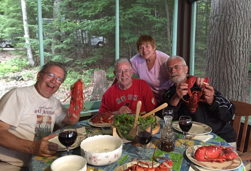
•Lake Winnipesaukee, New Hampshire
We drove until we reached Antigonish NS where we
spent the night. The next day drove to Bangor, ME for a night at the
Paul Bunyan CG (a very nice place with lots of grass and shade, which
we needed for a change!) The next day we made our way across Maine to
Lake Winnipesaukee, New Hampshire where we met up with another Desert
Trails friend, Frank Argersinger who spends summers at a family cabin
on the lake just north of Wolfeboro.
Frank’s cottage is the classic, comfortable New
England lake "camp" with knotty pine walls and cabinets, smallish rooms
appropriate to when the cottage was built in 1952 by his grandfather,
and a glorious picture window overlooking the lake. After showing us
around the grounds and cabin (plus guest cottage), we parked the RV in
a level spot, plugged to an outdoor plug, and decided it was a good
time to visit Wolfeboro. We walked the streets and for lunch had the
best lobster roll of the entire trip at the Downtown Grill Café (no
mayo or lettuce, only lobster!). We went to the grocery store for more
lobsters to have for dinner the next day with Bill and Barb Totherow,
another couple from Desert Trails who were going to drive up from their
home in Barrington. Before dinner, Frank took us all for a boat tour of
his area of this beautiful lake. Afterwards, we dined on what would be
the last lobsters we enjoyed on the trip.
V. RETURN TO NEDERLAND
We said good-bye to Frank who may not be returning
to Desert Trails; he’s building a home in Sequim, Washington, to be
near his kids and grandchildren (though he’ll return to New Hampshire
for an extended summer each year), and drove to our daughter’s home in
Milton in time to celebrate Fathers Day with the family. For the first
time, we think. We shared some Iceberg Beer with those interested, plus
a taste of Screech, a traditional Newfoundland rum/rhum (which we think
can be purchased throughout Canada, but apparently not in the States).
They had enjoyed daily Judy’s Facebook accounts of the trip and had
only a few questions.
Two days later we left for home, a generally sunny
and clear four days with stops in Pennsylvania (a rural state park),
Indiana (La Porte’s Yogi Bear Jellystone RV Park, which was trashed and
trashy), and Nebraska (another rural state park). With clear weather we
made much better time than we had coming out in May.
[Note: We
passed and were passed by lots of big
rigs: 18-wheelers, the kings of the interstates. Judy made the
unscientific observation that truckers keep their rigs sparkling. Take
a look for yourself the next time one of those big guys passes you.]
Lucy proved to be an absolutely outstanding traveler
and we don’t know how to really show our gratitude. She wouldn’t
understand anyway. She just did what she knew to do and, we think,
enjoyed herself. She’s the only dog we know who tasted the waters off
the coast of Newfoundland, made friends with other dogs wherever she
went, and did not disturb the local wildlife.
We learned much on the trip, especially that we
could find fascinating experiences, friendly people, go to new places,
see the countryside, and not let the weather get in our way. We simply
learned to work around it.
In all we traveled through 13 states, three
provinces, four and a half time zones, and 7,650 miles. We were gone
about seven weeks and, as usual, played ten hands of gin rummy almost
every night—nearly 400 hands by the end of the trip. Judy was the final
winner, 7449 to 6276. A good win on a great trip!
