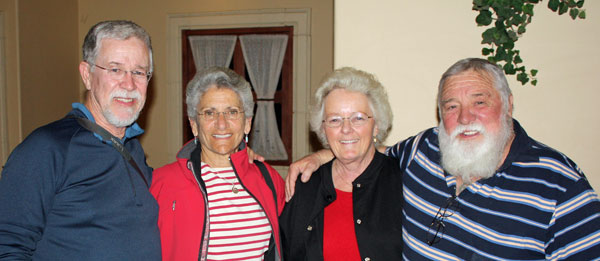
 DEATH VALLEY and
ARIZONA
DEATH VALLEY and
ARIZONA
February 26–March 25, 2010
THE BIG PICTURE
The drive from Nederland to Death Valley is 877
miles: two full days across I-70 to Salina, Utah, where we
spent a night, then south on I-15 to Las Vegas, and finally northwest
on US
95 to the east entrance to the National Park. After four days we moved
to Katherine Landing on the shore of Lake Mohave,
then drove down the Colorado River to
Quartzite,
and east to Tucson for three days of
family visits. South of Tucson is Patagonia Lake State Park
where we
did some semi-serious birding before parking in the driveway of a
friend’s house just north of Patagonia. We
returned to
the Tucson area for some R&R and visiting friends in
Marana. We
left for home by way of Albuquerque to visit old friends
while we waited for a window of good weather to make the dash up I-25
through Denver and Boulder to Nederland.
A brief memory of this past winter’s weather:
Seeking a shot of sun and warmth, we took a short but disappointingly
cool trip in February to Florida’s panhandle (Destin
specifically).
That didn’t work our as we planned, so we therefore hoped for the warm,
dry desert southwest to take away the chill. But this
was not ordinary winter, in any part of the country. We entered Death
Valley, one of the driest parts of the country, in a driving rain!
Several days later, Quartzite was hit with rain for most of the time we
were there. After that, all was as anticipated until we left for home:
we appealed for an extra day with friends in Albuquerque to slip north
between snow storms. Compared to other parts of the country, where
snowfalls
set records, we were fortunate—yet surprised by all the moisture but
grateful
for some warmth. We had hoped for fields of desert wildflowers, but we
were three weeks early. Maybe next year we’ll get it right.
DEATH VALLEY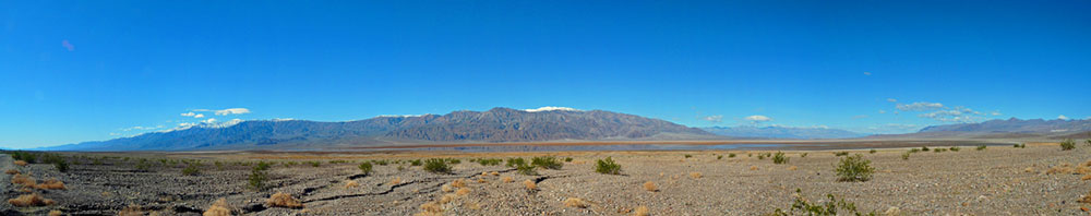
The rain that fell as we entered the park was
unusual, we were told, but not unheard of. About every 10-15 years a
few
inches falls and makes a real lake at Badwater, the lowest point in the
country. Of course, there were puddles everywhere. We got a site in the
RV
Park at Furnace Creek, which is primarily for use by permanent
residents and employees; a few slots are available for overnighters.
The appearance of this dilapidated unkempt place for RVs and permanent
mobile homes was hardly park-like. Perhaps that happens when the
government turns over the responsibility for management of certain
concessions to a private company. However, we did need the hook-ups
since our water system was still winterized from last fall and other
systems
in the rig needed to be checked out. After a couple of nights (at
$31/night) we moved across the street to the the Sunset
Campground, a
dry camping area
($6/night for seniors) for two more nights. Sunset Campground is
a giant gravel parking lot with bathrooms; it's pretty basic but
doesn't pretend to be anything else but what it is, which is clean and
level.
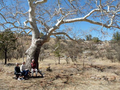
As planned, we met cousins Ken and Carol with
whom we would travel for the next week and a half. They pull a fifth
wheel and so we were able to ride with them in their pickup to
different areas in and around the park each day,
and take advantage of hikes lead by park rangers.
RHYOLITE
The first day we drove outside the park to the
nearby ghost town of Rhyolite,
Nevada, a true boom town that lasted five glorious years filled with
optimism and energy. The town sprang to life in 1905 with a gold rush
that brought thousands of gold
seekers and speculators to this desolate unpopulated area. Rhyolite
(named after
the silica-rich volcanic rock common in the area) grew from a barren
patch of desert to a city of up to
4,000–6,000 (some say as many as 8,000)
by 1907, with all the dreams and comforts of a big city-in-the-making,
including electricity, a water and sewer system, three railroads,
concrete sidewalks, a newspaper, telephones, an opera house, a stock
exchange and
three banks, as well as schools, churches, and a variety of stores. Did
we mention bars? The
San Francisco earthquake of 1906 started the decline
of mining investments which, along with a decline in mine production,
led to the
abandonment of the area: by 1910 there were only 675 residents, and ten
years later there were a scant, but hearty 14 folks who hadn’t given up
the dream (or had nowhere else to go).
Many of the buildings and materials were moved to Beatty, just a few
miles away. Today’s rise in the price of gold and an increase in
tourism have given
the town some income, though it’s unlikely to ever realize the dreams
folks had a
hundred years ago.
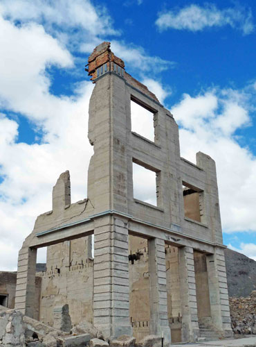
What has been left behind is worth the visit and a
walk through history. The once magnificent railroad station, which had
been converted into a casino when the trains left, stands in fairly
good repair behind a protective chain link fence; Tim Kelley’s famous
“Bottle House,”
made with the empties from his saloon—about 30,000 in
all, mostly from the Busch Brewing Co.—is watched over by the BLM; and
the skeletal remains of the ambitious Cook Bank Building (see photo),
claimed to be
the “most
photographed bank building in the state of Nevada,” soar to the sky;
it was built with imported Italian marble and featured electric lights,
a telephone, and inside plumbing!
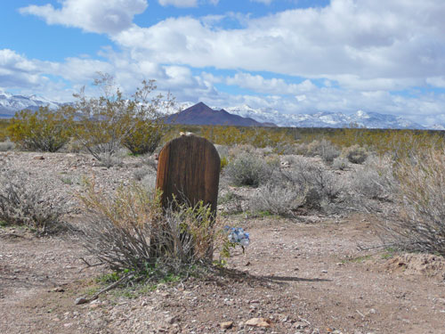
A mile or two below the town we walked through the
Bullfrog-Rhyolite Cemetery (Bullfrog was the name of the mining
district). It was a
bit of
challenge to locate since nothing in the cemetery stands taller than
the
desert
brush, but a few signs and dirt tracks more used than others led us
there. Fewer than 20 graves have been located, and only
nine names have been identified. Still, the cemetery is a testament to
the determination and courage of those who came to this harsh area in
search of wealth and dreams.
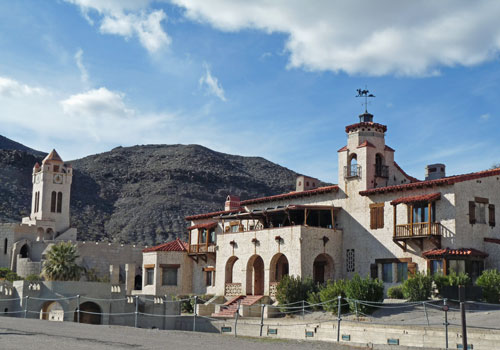
SCOTTY’S
CASTLE
After a picnic lunch across from the old train
station, we drove
back to Death Valley for a tour of one of the most unlikely and
remarkable homes ever constructed: Scotty’s
Castle. It is neither a castle nor did
Walter “Death
Valley Scotty” Scott own it. Rather it was an elaborate,
almost fanciful vacation house built by Albert
Johnson, a wealthy
Chicago insurance banker. The story
of how this remarkable complex
eventually was competed is worth the time to read about.
Johnson bought the land because it had access to a
good water supply, and because his wife, Bessie, thought the dry
climate
was good for his health. The story of Albert’s relationship with
Scotty, who was after all a liar, con man, and storyteller, is the
stuff of western folklore and myth. Johnson began
constructing what he called his Death Valley
Ranch in 1922, but completion was held up when President Hoover
proclaimed the
area a national monument in 1930. Further complications involved the
discovery of an inaccurate survey (the ranch was not on what he thought
was his property!)
and, in 1937, the death of Johnson’s
beloved wife. There is much more to the saga of building and
maintaining this
desert masterpiece, as well as the story of the unlikely relationship
that developed between the educated midwestern millionaire and the
scruffy western con man.
To reach Scotty’s Castle, we drove across the arid
landscape to the north end
of the park where the road led us up narrow, twisting Grapevine Canyon.
Around the last corner we saw mature palms and a
green grassy park next to a flowing stream that surround the 32,000
square foot home designed in Spanish-Moorish
architecture. We were delighted to have an outstanding and entertaining
guide, dressed in period clothes from the 1930s, who shared her passion
for the building and the people who are at the heart of this remarkable
venture. It is certainly worth the 53-mile drive from Furnace Creek to
the Castle. It’s an experience we’ll not soon forget.
HIKING
Borax Mine.
Ken and Hughes biked a couple of miles to the remains of an old borax
mine that was once a going business in the area, complete with wagons
and water tanks that hauled the ore out by mules. The site is
undergoing restoration and the self-guided trail around the site tells
the story of mining and transporting the borax under extreme conditions.
 [The name of
the mineral, borax (sodium borate), is used in the
production of the laundry detergent 20
Mule Team Borax and Boraxo,
the hand soap, both of which are still available. For those of you who
remember black-and-white television will remember that Ronald Reagan
hosted “Death Valley Days,” sponsored by US Borax. The iconic
mule team and wagon was always featured at the beginning of the show.
So even in our fantasies and nightmares, there may be a connection to
reality.]
[The name of
the mineral, borax (sodium borate), is used in the
production of the laundry detergent 20
Mule Team Borax and Boraxo,
the hand soap, both of which are still available. For those of you who
remember black-and-white television will remember that Ronald Reagan
hosted “Death Valley Days,” sponsored by US Borax. The iconic
mule team and wagon was always featured at the beginning of the show.
So even in our fantasies and nightmares, there may be a connection to
reality.]
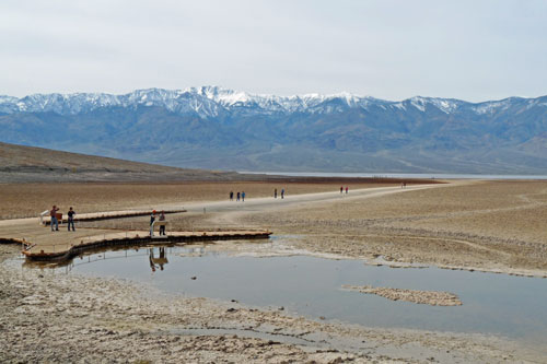
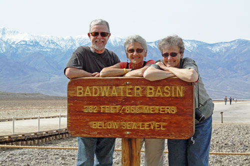
Badwater. At 282' below sea
level, “Lake”
Badwater sits in a basin in the lowest, driest, and
hottest place in the country. Visitors usually look upon an extensive
dry lake bed with 11,331' Telescope Peak in the distance. Our
experience was
quite different: we walked from the parking area, past a large puddle,
to the edge of a vast
lake surrounded by mud and white salt crystals that form as the
water begins to evaporate, which it does quite rapidly. The snow
covered Panamint Mountains provided a surreal reflection in the
water. We didn’t stay
long; there’s not all that much to see or do even at that elevation
below sea level except to admire the beauty of the area. We took our
tourist snapshots and left for an
interesting experience just down the road.
Natural Bridge. The canyons that surround the
valley are formed by the flow of rain and snow melt that erode the
sides of the mountains. The
bridge that spans this narrow canyon a few miles hike from the road was
formed by powerful, large floods that occur every 30–40 years. Ranger
Bob Stoepel,
a former geologist, described the mineralogy of the area, showed us
fault lines throughout the canyon, pointed out the alluvial wash and
fans that are common throughout the park, and explained why the bridge
was not an arch. It was the end of a
great day: informative, slow paced, fine weather, and good scenery.
Golden Canyon.
Judy, Ken, and Hughes bicycled south (and downhill!) from Furnace Creek
to the Golden Canyon area for another ranger hike. Carol met us there
with the pick-up to carry the bikes back for those who didn’t want to
pedal uphill. The terrain was, not surprisingly, a lot like what
we found at Natural Bridge: alluvial gravel at our feet (though the
first mile or so we hiked on the remains of a blacktop
road that predictably did not stand up to one of those every 30–40 year
floods). The gravel material consisted of smaller particles of a
lighter color, which contrasted with the varying colors of the
conglomerates of the canyon walls and the red-brown of the mountains in
the distance.
Mosaic Canyon.
Stovepipe
Wells is the area that serves visitors who enter the
park from the west. From Stovepipe Wells there are three miles of rough
road heading away from the highway to the
entrance to Mosaic Canyon. We saw most of the same alluvial rock and
gravel we found elsewhere, but here it is overlaid upon a thick marble
formation that is quite smooth,
beautifully striated, and quite slippery to walk on. We walked just a
bit
over a mile to appreciate how different this side canyon is from what
we had seen earlier. On the way back, we drove by but did not stop at
the only real sand
dunes we saw in the park. Mosaic Canyon was to be our final hike in
Death
Valley.
After three days, we decided we needed to vary the
scenery, though we all agreed that, while we had seen much of what the
park has to offer, there is more for visitors than we saw,
especially those who come with 4-wheel drive vehicles at other
times of the year. We were fortunate to see Death Valley at a
particularly wet time, but many back country roads were closed because
of wet or snowy conditions. We would have rented a jeep to see some of
the outlying areas, but snow and mud made access impossible. Next time.
LAKE
MEAD NATIONAL RECREATION AREA
The four of us left Death Valley and convoyed to Las
Vegas through Pahrump (Nevada), stopping long enough to buy groceries
and get a very minor repair to the RV (an electrical glitch) that took
a scant few minutes to locate and fix.
[Last summer
on our trip back east, the customer friendly folks at Charger
Enterprises in Elkhart, Indiana, solved three minor problems for us
as
we were leaving town. “No charge, folks. Have a safe trip,” was what
they said
when we asked how much we owed them. The people at Super Service RV
in Pahrump have a much different policy. For the three minute “repair,”
Brian (the service manager), after filling out five different forms on
his new computer and printer, charged a half hour service fee.
Outrageous. Even he thought so and said as much, but he was worried
what
would happen to
him if “his boss” found out. We wonder how long he’ll last, always
looking over his shoulder or passing the buck to someone else.]
On past Las Vegas on US 95 we stopped at
Katherine
Landing at the Lake Mohave section of Lake Mead National
Recreational Area near Laughlin and
Bullhead City. The campground there was a pleasant change from the
“parking lot” at Death Valley: trees covered the grounds for shade and
privacy overlooking Lake Mohave (really a wide place in the Colorado
River). The campground was nearly full, yet
quiet, with little traffic, and nicely organized; five dollars a night
bought us flush toilets, a comfortable and interesting place to
relax, and good
hiking. It was so nice we decided to stay a little longer than
planned.
Judy ran each morning for the first time in
several days. Hughes biked and hiked up to the Katherine
Mine several miles away.
The Katherine was the location of an early 1900s gold strike that was
not fabulously productive, but enough gold was taken to keep a few
miners busy through the early years
of WW II when the government closed it as they did a lot of mining
ventures because of the war. We walked the dogs regularly around the
campground area and down to the marina, watchful for coyotes that were
known to be in the area.
One day we drove to Bullhead City looking for a
frabic/knitting store to resupply both Judy and Carol. Our GPS was no
help and we were about to
drive back in frustration when we stumbled upon Marge’s Hobby House along
the main street. Marge’s is the knitting, sewing, and crafts
equivalent of an old
time hardware store: she has bins and shelves and displays and counters
containing every possible yarn type, needles of all sizes,
patterns, and all the things Judy and Carol wanted—and many they didn’t
know they wanted. Marge’s is a treasure to all those who think Jo-Ann
Fabric sets the standard for those who knit, paint, make dolls, do
macrame, embroider, crochet, sew—even decorate cakes.
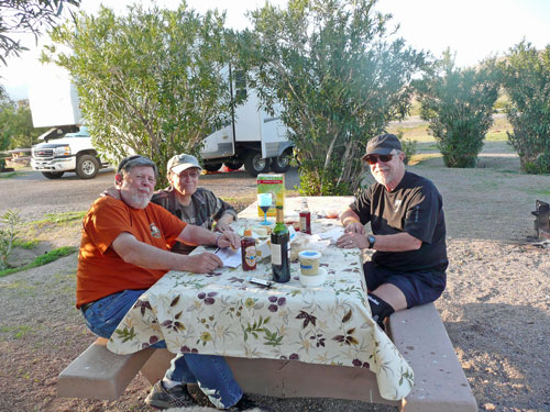
[One of the
many pleasures of traveling with Carol and Ken is, not only that are
they good company and always cheerful, but that they are card
players. In Puerto Vallarta the four of us played Shanghai Rummy nearly every
day. We did the same on this trip: cards and cocktails before dinner
and again after dinner until we pooped out, usually before 9:00. That’s
another thing we have in common: we all go to bed early.]
QUARTZITE

We passed Lake Havasu City on the way south to
Quartzite. One
of us
wanted to see London
Bridge. We learned that it was purchased in 1968 by Robert
McCulloch (of chain saw
fame) and
transported brick by brick, stone by stone from London to Lake Havasu.
Reconstruction was completed in 1971 and the bridge, which connects the
town to Havasu Island and Lake Havasu State
Park, has become Arizona’s
second most popular tourist attraction (after the Grand Canyon). We
have
no idea how many visitors are surprised and underwhelmed upon first
seeing the bridge; McCulloch, after all, did not purchase London’s Tower Bridge,
which is what many people think of when they imagine London Bridge.
(Maybe McCulloch was fooled too?) We
did enjoy walking the dogs along the river walk on the island, watching
folks riding bicycles, playing frisbee, and relaxing on the many
benches placed throughout this lovely shaded park.
We continued south to 88 Shades RV Park in
downtown Quartzite,
where we had stayed
last winter. The
park hadn’t change in a year, though there were
puddles from recent rain and the weather was a bit cooler than last
year when we were there in February. We paid for two nights ($22.50,
including cable and wi-fi). This is a very
welcoming and comfortable place to stay: they have lots of planned
activities (concerts,
breakfasts, cards and games, etc.) and amenities (free car/truck/RV
wash station, a place to change your oil, and fresh picked oranges
every day until they’re gone). Judy did our laundry and, since it was
sunny and dry day for a change, we hung it on the clotheslines
provided. Ken and Hughes enjoyed the (free) ice cream social on Sunday
afternoon where they ate their monthly quota with hot
fudge sauce.
Quartzite is best known as the home of probably the
largest combined gem show/RV Expo/swap meet/Indian pow wow in the
country. Some reports claim
a million people travel to this small desert town each
winter, especially for the swap meet, gem show, and related
events. The greatest
number of vendors and displays come in the last part of January
through early February. By the time we arrived (early March) at least
80% of the vendors had moved on for other shows in other towns.
However, we
still had fun and the selection was smaller but almost as varied as the
“big” show. We didn’t spend much money and not nearly as much time as
last year.
TUCSON
 Judy and Carol have a first cousin who lives in
Tucson, and it’s our pleasure to visit Bob and his wife, Ginny, when we
are in the area. We chose to stay, sight unseen, at the Far Horizons RV
Park because it is close to Bob and Ginny’s. Next time, we’ll stay a
bit further away. Far Horizons is overpriced without many amenities and
lots of restrictions that probably suit the folks who live there full
time.
Judy and Carol have a first cousin who lives in
Tucson, and it’s our pleasure to visit Bob and his wife, Ginny, when we
are in the area. We chose to stay, sight unseen, at the Far Horizons RV
Park because it is close to Bob and Ginny’s. Next time, we’ll stay a
bit further away. Far Horizons is overpriced without many amenities and
lots of restrictions that probably suit the folks who live there full
time.
We met Bob and Ginny at their favorite restaurant, La
Parrilla Suiza, where the two of them go often enough that they
know
the staff well. It also serves good Mexican dinners. We caught up
with family news and what’s been going on since we saw them last year;
we continued
talking into the evening at their home. Ginny’s brother, Gary, was
there as was
their granddaughter, Abrianna, and her son, Damion. In the morning we
shopped at the local Sunflower for groceries, and Judy went for a
morning run. After lunch we returned to Bob and Ginny’s for more
stories and family photos. Later we drove to an RV dealer for a major
repair.
[While we
were in Death Valley, our awning brackets
failed and the awning partially fell away from the side of the rig and
some internal parts broke. After calling
the insurance folks to report the damage, we called or stopped at
several RV dealers to see if they could fix the problem. Most couldn’t
or wouldn’t, but La Mesa RV in Tucson, an authorized Itasca dealer,
said they could and would. It meant changing our itinerary and
extending our trip nearly a week. So we left the awning with them and
planned to return
in two weeks to have the repaired awning reinstalled. When we returned,
they said they
fixed
the awning but had received the wrong brackets to secure it to the RV,
which could take
another week or more to deliver. We returned home to Nederland with the
awning inside the RV and planned a date with
dealership in the Denver area. After two weeks, they, too, received the
wrong brackets and a month later it’s still not fixed!]
PATAGONIA
We said good-bye to Ken and Carol who were returning
to their favorite RV/golf park in Naco (Arizona) on the Mexican border.
We set
our sights on Patagonia Lake
State Park, about halfway between Nogales
and the town of Patagonia. It’s a comfortable and scenic state park
with
gentle trails and a small lake for fishing. We had stayed there before
and looked
forward to several days of relaxing, some
hiking and, as it turned out, some serious birding. We were
not sure how long we would stay; we were to contact David and Lada,
friends who
were staying at another friend’s home north of Patagonia who had
suggested we park our RV in their yard for a time to visit. David had
run on Judy’s relay team that completed the 195-mile Wild West Relay a
few
years ago; they will be on the same team that is entered in the
200-mile “Reach the Beach” relay
in New Hampshire in September. David was looking forward to taking Judy
running in the back roads and the Arizona Trail near Patagonia.
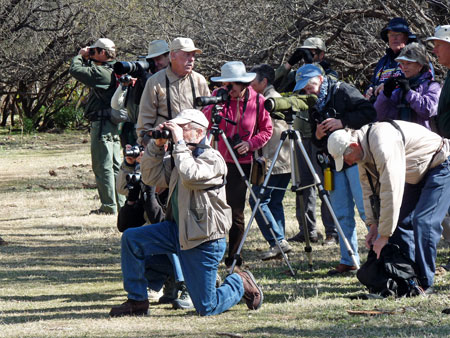
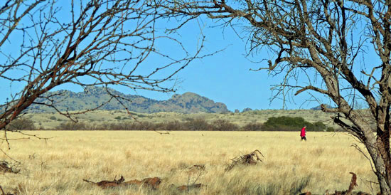
When we checked into the park we learned that
morning bird walks
were scheduled each day. Led by volunteers from around the
country and Canada who come to the area every year, the walks promised
a reasonable start time (9:00 am) and would last about three hours. We
followed the group along the east side of the lake into areas of
mesquite,
marsh grasses, and hardwood trees. The group of about 15–20 birders
were most enthusiastic, armed with spotting scopes, long lenses, and
field guides. One volunteer kept a daily record of confirmed sightings.
We felt a bit out of their league, but they willingly shared their
knowledge with us and helped us fit right in. We learned a few tricks
about how to spot and identify the many birds we saw: ruddy ducks,
herons, and coots in the water; robins, several variety of woodpeckers
including
the first Arizona woodpecker of the season, flickers, verdins,
goldfinches, vermilion flycatchers, and many others in the trees away
from shore.
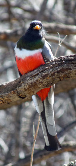
One bird in
particular was considered a prize to spot: the Elegant
Trogon. We joined in the search for this elusive and fairly rare
bird (its range is largely in Mexico and in a small area in the
southeastern tip of
Arizona). On the second day, we met a couple of guys carrying serious
video
and sound equipment who had been up since before dawn and were on their
way back to the campground; they said they had spotted and filmed an
elegant trogan in the area near when we were headed. Of course we all
spread out in the particular wash covered with mesquite to search. An
hour or more later someone spotted the bird and we all clustered around
observing
and taking lots of pictures. Fortunately, the elegant trogon is not
camera shy nor particularly skittish so long as he doesn’t feel
surrounded. He certainly wasn’t bothered by the harsh clicking of a
dozen cameras going off incessantly.
Cell service in the park is very spotty, but Judy
found a spot where she could place a call to
David and Lada at the Patagonia House. They didn’t answer, but she left
a message saying where we were and that since cell service is
unreliable,
we’d try again. That evening we were surprised when they knocked on the
door of the RV and invited us to dinner in Nogales, a short 20 minutes
away. We spent the evening getting reacquainted and made plans to move
to the Chapin Hacienda up Casa Blanca Canyon (see photo below), giving
us explicit
directions for
finding the place. David also told Judy of a race in Nogales the
following Saturday that she might enjoy running. David was going to run
the half marathon and Judy decided the 5K would be more her speed. Lada
was going to volunteer and the three of them would leave at 5:00 am.
Hughes decided he should stay with the dogs (and sleep in).
[The
Race for Goodness in Nogales
was the
inaugural event and we hope the organizers learned a lot about putting
on a good race. Online results are still incomplete. At the last
minute, the course was changed at the request of the city police for
safety reasons, making the 5K distance 3.5 miles and the half marathon
a 14-mile event. The awards were really disorganized: David is 70 years
old and we believe finished ninth overall; he was certainly the only
guy over 40 or so to finish. He received a trophy that reads “First
Place 19-Under.” Judy was the third overall female, and clearly the
oldest of the women runners. She did not receive a trophy; she did,
however, receive a phone call that evening from the race director (he
knew we were staying with David and Lada) apologizing for the oversight
and promising that she would
receive her trophy (whatever it might say on it) in the mail. A month
later it has still not arrived.]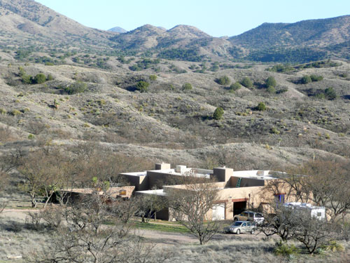
When we arrived at the Chapin Hacienda, we parked
the
RV in the drive, turned the dogs loose, got a tour of the lovely adobe
house and patios, and plugged into an electric outlet in the garage.
Since David and Lada were responsible for the well-being of two house
cats, we decided that we would sleep in the RV with the dogs rather
than in the
bedroom waiting for us. This arrangement worked out well for both us
and the
dogs, who don’t know much about cats except that they are interesting
and fun to chase. The cats probably would object.
What an enjoyable time we had with David and Lada!
In the brief time we were together, we drove with them all over the
area:
•Through the wine country of
nearby Sonoita and Elgin;
•To a trailhead at the head of
Santa Rita Canyon on the Arizona
Trail to evaluate part of a 15-mile
stretch of the trail for a possible long run for David and Judy (It was
pretty rocky, steep, and in some places too wet for Judy to feel
comfortable running or for Hughes to bike);
•We biked six miles into
Patagonia one
Sunday morning for the tiny farmers market and to meet
David and Lada who had gone to church in Nogales. Patagonia is small
(less that 900 population) but has interesting shops
and historic buildings. We did find some organic produce and good
snacks at the Red
Mountain Foods store, a former coop that has retained the informal
atmosphere of the original business. When David and Lada found us, we
put the bikes in the back of the car and drove to another
trailhead on the Arizona Trail, which Judy decided still was more
distance than she was prepared to do;
•We drove to the ghost town of
Harshaw
with its glorious cemetery (on the hill in the background) still well
maintained, though the
lone
remaining town building is in a state of supreme disrepair. The
townsite lies in an area of magnificent sycamores that go back before
the town was laid out. We looked
for Mowry, another ghost town in the area, but never did locate it,
even with the help of one of the many border patrol personnel who we
saw parked throughout this sparsely populated area;
•While Lada was at an all-day retreat
at St. Rita’s Abbey, we went
rockhounding with David and the dogs for rhodachrosite and pyrite at a
site recommended in
Mitchell’s Gem
Trails of Arizona
(Gem Guide Books, 2001): Providencia Canyon just off the Duquesne Road,
east of Nogales. According to Mitchell, this area “In
addition to the often
beautiful pink rhodachrosite is renowned for its often large pyrite
crystals.” The road was steep but in good condition. When we were close
to the mine dumps, we turned the dogs loose to sniff for gemstones
while we ate a picnic lunch. Locating “large pyrite crystals” was a
challenge, as was finding rhodachrosite crystals larger than a quarter
inch.
However, we did return with lots of surface pyrite and a “Johnny Rock”
for the Chapins’ patio.
Judy and David did get in a good run up Casa Blanca
Canyon near the house, a six mile out and back route on a smooth dirt
road surface. Our evenings took on a very pleasant routine: cocktails
or wine before dinner and cards afterwards: they taught us “Krazy
Kings,” a delightful and easy to learn variation on rummy that we have
played with others since. Lada and David were excellent hosts and
quite hospitable: always interesting conversation and very upbeat.
On the day we said good-bye to David and Lada, we
drove north through Sonoita
to visit the Empire Ranch, just off State Highway 83 towards Tucson,
which David and Lada recommended to us. We stopped and walked around
the main buildings,
though without someone there to be an official guide we felt more like
intruders than visitors. So we continued to drive further east out into
the Las Cienegas Conservation Area, a large tract of public land. After
several miles of a graded dirt road we spied what turned out to be a
new bathroom building (pristine
vault toilets and lots of toilet paper) and a very flat area on the
other side of the road. The landscape reminded us of the Serengeti with
mesquite
rather than acacia trees and minus the wildebeests and zebras. We
decided this was a perfect place to spend at least one night. We let
the dogs loose without worrying about cactus and cholla prickers or
hills to block our view of them. Judy ran on the flat dirt roads, and
together we biked miles into the public lands. Away from towns
and city lights, a million stars came out that night and all we could
hear was the sound of the gentle wind and our breathing. It was
glorious!
TUCSON AND MARANA
We left the serenity of the Las Cienegas Conservation
Area to return to Tucson. We took a southern route through
Sahuarita, one of the major pecan growing areas in
Arizona, past the huge tailings of ASARCO’s copper mining complex on
the south side of Tucson, to San Xavier.
San
Xavier Mission
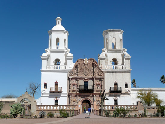
We stopped for a tour of the San
Xavier del Bac Mission, a startlingly beautiful church begun in the
17th
century by the Jesuit Father Kino and ultimately completed by the
Franciscans in the 18th century following the suppression of the
Jesuits. Damage from earthquakes and lightning made
restoration necessary in the 19th and 20 centuries. In fact,
reconstruction seems to be ongoing to maintain the building’s integrity
and
stability. There is no entry fee and the small gift shop and donations
help to raise funds for the church’s upkeep. This unique landmark,
constructed
in an isolated region of “New Spain,” is remarkable for its design and
architecture and for the beauty of the interior religious paintings and
artwork. It is an experience not to be missed; it would be like going
to Paris and not visiting Notre Dame, or skipping St. Mark’s Cathedral
in Venice.
Desert
Trails RV Park
We don’t often rave about a campground or RV Park.
We’ve stayed at some good ones, some cheap ones, and briefly endured a
few ugly
ones.
But Desert Trails is
in a class by itself. A fellow camper and birder we met at
Patagonia Lake State Park was planning to
return to this campground located about 20 miles west of downtown
Tucson. She thought we might like it if we were going to be staying in
the area. It is near Tucson Mountain
Park, Saguaro
National Park West, the Arizona-Sonora
Desert Museum the and the Old
Tucson Studios, each of which is worthwhile visiting.
Desert Trails charges a daily rate of $24 and there are no other
charges for such things as wi-fi, soft drinks, coffee and tea at
all
hours, laundry (there are three), a dog wash area, swimming pool and
hot tub, and daily activities/classes that are extensive and cover a
variety of interests. They maintain a complex of hiking trails
adjoining the park grounds and have samples of native plants throughout
the grounds. It is, in short, a gathering place for friendly, active
people from all over the country and Canada to enjoy the best of
southwest winter weather and sights. (We did run into the woman from
Patagonia Lake and thanked her for the recommendation.)
Marana
Some years ago, Nederland neighbors Jim and Sandi
invested in a duplex in a golf resort development in Marana, a
suburb of Tucson 20 miles to the north. The
development is an area of lovely duplexes with a first rate golf course
and a clubhouse with planned activities, exercise equipment, and a
pool; there is also a fine running trail along the edge of the area. In
spite of the density
of homes, it’s quiet with a focus on wildlife (bobcats, javalinas, many
birds, rabbits, etc.) and a wide variety of desert plants. For many
reasons,
we think it was a good investment for them.
We visited them for a chance to relax, play some
cards,
and give Sandi her “dog fix” for a few days. This year we had the added
“excitement” of Lucy eating some poison that a neighbor put out to kill
moles and other rodent critters. Unfortunately (and thoughtlessly) he
did not consider the possibility that other animals (perhaps even
children) might be attracted to the pellets: birds, cats, coyotes,
rabbits, bobcats, and dogs which are frequently on walks throughout the
neighborhood. Putting the pellets out—even on his property next to the
sidewalk—poses a real danger, and Lucy (on leash for her evening walk)
at least sniffed, perhaps ate,
some pellets and had to be rushed to a 24-hour emergency vet clinic for
medical treatment and overnight observation. Judy enlisted the help of
the national poison control hotline (after she was able to get the
homeowner to admit he used poison and ultimately—and
reluctantly—relinquished the
bottle so that the vet would know what kind of poison Lucy got into),
and reported the incident to the local police. We were surprised to be
told by the investigating officer that in Marana it’s OK for
homeowners, even in densely populated neighborhoods,
to scatter poison on their property without regard to unintended
consequences or ignoring the specific directions for its safe use
(e.g., avoid putting it out so that it does not get into water runoff,
or where birds and other wildlife can get to it, etc.). It was our good
fortune that Sandi and Jim were able to locate the emergency vet
clinic, drive us there very
quickly, and that the vet knew the poison
(“It’s really bad stuff”) and knew how to treat it. We are very
grateful the staff at the Ina Road Animal Hospital
in Marana for their quick and effective response to what was a
dangerous and emotional situation. Follow-up blood tests
here in Nederland when we returned confirmed there was no permanent
damage to the kidneys, liver, etc., and Lucy is very much back to
normal. The only reminder of the incident are the shaved strips around
her front legs from where she had IVs at the vet’s office. It makes her
look a lot like a poodle with a fancy “do.”
ALBUQUERQUE AND HOME
We try to stop in Albuquerque as often as we can to
visit with Anna
Marie, who was our neighbor in Ohio when our families first moved there
in 1969 and with whom we’ve kept in touch ever since. This year, we
also watched the weather between Tucson and Albuquerque, and between
Albuquerque and Nederland. Somewhere along the way we thought we’d run
into stormy weather. Luckily, we left Marana in sunshine that followed
us all the way across I-10 to Deming, New Mexico, and up to I-25. We
stopped at Hatch long
enough to buy Anna Marie a supply of Hatch chiles for which that
the area is
famous. She knows how to cook tasty Mexican food with them. The sun was
still out by the time we reached her house where we she had a lovely
dinner for us, and her son Erik who joined us later. We watched the
weather report for the following day, which predicted a major winter
storm for north-central New Mexico along the stretch of I-25 between
Las Vegas (NM) and Raton at
the border with Colorado. We prevailed upon Anna Marie to enjoy our
company for a second day. She agreed and a day later we finally made
the drive home without
incident. We saw the piles of snow the plows had left along the highway
all the way to Raton Pass, where there were slush and some icy patches
coming down into Colorado.
We arrived home to find our drive had been plowed
since the 20" snowfall the previous couple of days. All we had
to do was to crank up the snow thrower to clear the 50 feet of gravel
that leads up to the garage (we don’t get that plowed because the
gravel would not stand up to the plowing). Hughes didn’t get much
plowing done because, as he learned the next day, he was having a heart
attack. (That sounds pretty dramatic, but it’s true. What we thought
was a case of “walking pneumonia” was something else quite different.)
Well, that’s all been taken care of as you know from recent emails and
he will soon be able to get back to the “manly” chores around here
(throwing
snow, chopping wood, lifting rocks, leaping tall buildings, etc.) in no
time
at all. Of course, in the short run he has to let Judy do those things
because he’s not supposed to exert himself too soon. Thank goodness
she’s a mountain woman!
EPILOGUE
All in all,
it was a trip we’re not likely to forget
for some time. It was wet where it was supposed to be dry, cool where
it was supposed to be warm. We found a castle in the middle of a desert
and a
masterpiece of a church built in the middle of nowhere. We lived
through a dog poisoning
and a heart attack. We spotted an Elegant Trogon where they’re not
usually found
and found a campground we can’t wait to go back to for another visit.
What a
time we had!—and we’re looking forward to going back again next year
(even if we have to carry our passports when entering Arizona.)
