 CAMPING
UTAH
September
17 – October 10, 2009
CAMPING
UTAH
September
17 – October 10, 2009
BIG
PICTURE
Judy scheduled a race (Melon Run 5K) in Green River, Utah,
our first stop leaving Colorado. From there we drove south across the
San Rafael Swell, through Capital Reef National Park, to the St. George
area where Judy ran in the Swiss Festival 5K in nearby Santa
Clara, just a few miles from Snow Canyon
State Park where we camped
for three days. After a short visit to Zion National Park, we drove
into the Arizona
Strip to Pipe Springs National Monument, south to Jacob Lake, and
then north to Kanab for six days and our volunteer duties at Best Friends
Animal Sanctuary. We left Kanab for three days of camping at
Kodachrome
Basin State Park. On the way back to Nederland we camped in the
canyon
of the Burr
Trail, and stopped at Green River again for a box of melons to
enjoy at home. The red hearts on the map show best camping areas
described below.
A FAMILY TRAGEDY
This was intended to be a trip to explore the
western part of the
Utah—poking through old mining areas and ghost towns in
the relatively unpopulated areas between I-15 and the Nevada
border—and for Judy to run
some out of state races before arriving in Kanab to work at
Best Friends. We did not
count on the extreme heat in late September and early October: we had
several days above or near 100° which made dry camping in the
desolate western part of Utah problematic, especially without shade or
air conditioning (yes, we’re a bit soft, and so are the dogs).
Nor did we anticipate a heartbreaking family
tragedy:
the untimely and sudden death of our beautiful, gentle
Sophie, who we
think ate some poison put out to kill off coyotes, rodents, or other
wild animals that are pests to area ranchers on or near BLM
lands where we camped and hiked. Three days into the trip, near Torrey,
Utah, this is
how we described the events of Sunday, September 20:
[Judy
and Sophie had a miserable and unsettling night trying to sleep. At one
point Sophie jumped off the bed onto the floor, something she never had
done. Judy lifted her back up onto the bed and she spent the rest of
the night there, but when Judy woke she found that Sophie had peed in
her bed. Worse, she was weak to the point where she couldn’t stand on
all four feet and couldn’t hold her head up. It was as if the strength
had left her muscles.
We drove the few miles into Torrey and located an area vet who
would
see us as soon as we could get to his clinic, in spite of it being
early Sunday morning. His place was about 15 miles west of town. Lowell
Volden, who was having coffee at the Texaco station from where Judy
called,
generously offered to lead us to the vet’s place. We followed Lowell
down the
highway and dirt roads to Dr. King’s house/surgery.
Dr. Verlin King confessed he is more a large animal vet than a
dog or cat vet, but he looked at Sophie while she rested on his exam
table, checked her gums (they were very pale) and felt her abdominal
area. His best guess, without x-ray facilities, was that she was
bleeding internally from either a rupture (perhaps a tumor rupture), or
from eating poison preventing her blood from coagulating. He gave her a
vitamin K injection to help coagulation. It was the best he could do
for her. In any case, he urged us to drive the hour to Richfield where
there were two other vets with equipment, though when he tried to phone
them he got no response except a phone answering machine.
We drove to Richfield, several times calling the vets in
town, especially Dr. Deon Kelsey who at least left his home phone “for
emergencies only.” We left at least three pleas for him to call us back
as soon as possible. No response. When we were finally able to locate
his clinic, we parked in front and called 911 (sheriff’s office) who
sent a very concerned and helpful animal control deputy who contacted
everyone he knew who knew Dr. Kelsey, checked where he went to church,
checked his house, checked his secretary, and so on. He was not to be
found.
All the time, Judy was holding and comforting Sophie, who was
still but whose breathing was quite labored. Shortly after noon, she
took her last slow gasps and then very quietly passed away. She looked
very comfortably asleep in her cuddle bed as she always did. When the
animal control deputy came with another progress report—no news—we told
him
that Sophie had died and thanked him for all his efforts.
We wept and mourned her passing, then thought what our next steps
might be. Judy called Best Friends Sanctuary to arrange for burial at
their cemetery, Angel’s Rest. Mary Pat at Best Friends said there would
be a site at
Angel’s Rest waiting for us that afternoon. So we drove south. As we
were on our way to
Kanab, about 130 miles away, we changed our minds: We decided that we
wanted to have Sophie’s remains at home where we have graves and
memorial markers for Gordie and Phoebe, as well as Michael and Cindy’s
Bonnie.
We will hang a wind chime in Sophie’s honor at Best Friends
Angel’s Rest as we had for Gordie. Judy called Mary Pat back to explain
our change of plans, and Mary Pat recommended that we contact Forever
Friends Pet Cremation who did cremations for Best Friends in
Toquerville, near St. George. Judy
called Lisa Van Valkenburg, owner of Forever Friends, who
sounded very kind and caring. In addition to cremating Sophie’s body,
she would provide a handmade urn and a paw print for us to take home.
She agreed to meet us that afternoon. It was a very hard thing to do,
but we left Sophie’s body in her care, confident that she would be
treated with respect.
We returned in the morning to pick up Sophie’s ashes and urn from
Lisa and her daughter, Angel, who works with her mother. She also gave
Judy a card with a personal note and a print of Sophie’s paw next to
the message. We could not have found a more wonderful and caring person
to carry out our wishes for Sophie’s remains.]
We spent several days in nearby Hurricane
(pronounced HER-a-cun) at the very comfortable Willowind RV Park, coping
as well as we could with the loss of our beloved Sophie and deciding
whether to return home or continue with our trip. For two days we
sat and talked, we biked, ran, walked Bella, or
read, trying to ease the
stress and come to grips with the unhappy change in our lives. In the
end, we
decided that home at that moment would feel especially empty and that
the distractions of camping and hiking, as well as working with the
dogs and other animals at Best Friends might begin our healing.
THE
RACES
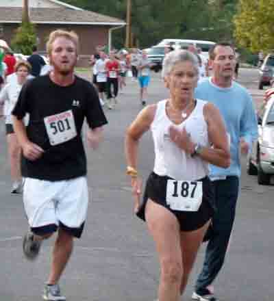
•Melon Run.
Green River, Utah, is the county seat of Emery County. It boasts
the John Wesley Powell River
History Museum, located along I-70 on the banks of the Green River.
The town
is home to an attractive state park, a public golf course, the nearby Crystal
Geyser and the San
Rafael Swell, maybe the sweetest melons in the country, and nearly
1,000 folks who seem to be hanging on to a way of life that has gone
through economic ups and downs.
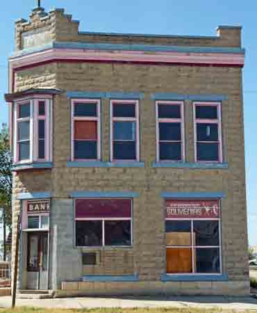
[How
and why does a town go ghost? If the mine fails or if an industry goes
belly up, the reasons are clearer. We don’t know what’s
going on here, but you see in an instant that Green River is in
transition: Empty buildings seem to outnumber the open stores; there is
now only one small grocery store; the once-proud bank—built of brick to
endure forever—in the heart of town had, on our last visit two years
ago, been taken over by a T-shirt/souvenir shop, and today even that is
boarded up. Only motels and gas stations thrive, though several gas
stations and motels lie derelict along the main street. For
a town that relies on tourism, Green River seems headed in the wrong
direction.]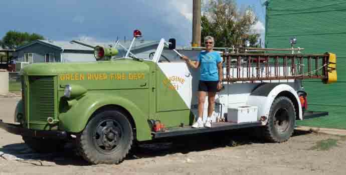
However, melons remain their pride and joy.
Family growers, like the
Veteres, the Thayns, and the Dunhams, have built a reputation for
raising the sweet melons over a half century. The annual Melon Days
festival honors the local cantaloupes, Crenshaws, watermelons,
canaries,
Israelis, honeydews, and honeyloupes. The
festival events include a craft show and sale with kids activities and
free melon on the lawn of the attractive city park; a very entertaining
hour-long
parade featuring two marching bands and every fire vehicle, old and
new, except for the ancient ladder engine with four flat tires; and,
for the first
time, the Melon Run. This low-tech, hand timed, paper and pencil 5K
race attracted about 50 local runners and one older lady from out of
town. Judy was the fourth female and seventh overall. Judy was pleased
with her time: 27:11 for the 3.13 miles as measured on her GPS that she
wears on her wrist. She
agreed it was fun and her reward was all the watermelon she could eat.
 •Swiss
Days
5K. Just west of St. George is the small town of Santa Clara that honors
its Swiss heritage by hosting an annual festival that
features family oral histories, pie baking competitions, a “Little
Swiss
Mister and Miss” pageant, historical tours, and individually decorated
cows in front of many homes in town.
•Swiss
Days
5K. Just west of St. George is the small town of Santa Clara that honors
its Swiss heritage by hosting an annual festival that
features family oral histories, pie baking competitions, a “Little
Swiss
Mister and Miss” pageant, historical tours, and individually decorated
cows in front of many homes in town.
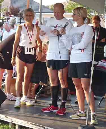 With nearly 600 runners,
their 5K race is the
biggest
fundraiser for the community. With daytime high temperatures predicted
to be near
100°, the race started in the pre-dawn light and finished just
about the time the sun came up. The course wound through town, ending
at the town hall where a generous and delicious pancake breakfast was
served up, followed by
awards and speeches. Judy’s time was good enough to win
her age group and finish 70th out of 270 women. The
scoring was efficient and prompt: about every five minutes, someone
from the scoring team would bring several sheets of printed cards with
runners' names, times, place, etc. and put them on a table so
individual runners could get their personal results on a card.
With nearly 600 runners,
their 5K race is the
biggest
fundraiser for the community. With daytime high temperatures predicted
to be near
100°, the race started in the pre-dawn light and finished just
about the time the sun came up. The course wound through town, ending
at the town hall where a generous and delicious pancake breakfast was
served up, followed by
awards and speeches. Judy’s time was good enough to win
her age group and finish 70th out of 270 women. The
scoring was efficient and prompt: about every five minutes, someone
from the scoring team would bring several sheets of printed cards with
runners' names, times, place, etc. and put them on a table so
individual runners could get their personal results on a card.
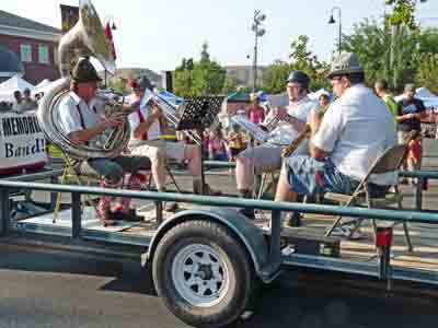
The parade that followed was a terrific typical
small town event: three marching bands plus a spirited German
oompah-pah
quartet, local organization floats, majorettes, an old timers float,
kids in traditional Swiss costumes, farm vehicles, old cars, a tank and
other military stuff all followed by fire department vehicles. A ton of
candy was tossed all along the route. We also stopped at several
garage sales
along the main street that had a few bargains which we picked up.
[Speaking
of purchases, we should go on record that we celebrated our 48th
wedding anniversary a few days before with an exchange of gifts, which
is not something we usually do. This year, however, we each received
two decks of “Bicycle” brand bridge cards and we each now have a beaded
seat cover for the long days of sitting in the RV. We are easily
pleased, aren’t we?]
On our return to Snow Canyon where we were
camping,
we drove to the small boutique community of Kayenta where well-off
retirees live in high desert adobe-style homes at the base of scenic
red rock
cliffs in a planned a neighborhood with a swimming pool, tennis courts,
lots of building restrictions, plenty of space between homes, a few
expensive retail shops, and a place to have coffee and buy a
paper. It might be very nice, we thought, for about six months of the
year for some folks.
BEST
FRIENDS ANIMAL SANCTUARY
Kanab is not a large town; just under 4,000
folks live there. It’s small enough to bicycle everywhere, but there
are enough shops, stores, and sights to hold our interest for two days.
We arrived a day or two early for our scheduled volunteer time at Best
Friends, so we made it a point to see as much of town as we could. It
was part of our “slow down“ strategy. We visited the historical museum
and saw photos of early settlers, memorabilia about families, schools,
and local organizations. The curator was a very pleasant woman who was
happy to chat with us about the town's history. In the basement of the
museum is an
art gallery with a fine display of works by local photographers.
The two grocery stores in town have about
anything
you need; there are several hardware (including Ace and Tru Value) and
auto supply stores; there are three movie houses all of which operate
on a part-time basis; the thrift shop is worth only a quick stop; and
there are plenty of places to eat. We had lunch the first day at Lotsa
Motsa Pizza, which offered a buffet lunch for two with fine tasting
pizza, a really good salad bar, hot chili or soup, and dessert sticks,
all for $2.50/person with a special coupon from the Hitch-N-Post RV
Park. For lunch it’s hard to beat.
Another nice thing about Kanab is the array of
towers and antennae that stand tall on the vermilion cliffs
overlooking town. Area residents have great cell phone and internet
service, and a wide range of digital television stations are easily
available. By the time we moved out of town to Best Friends just five
miles to the north, we lost internet and television reception, though
cell service remained strong.
Angel Canyon, located along the Kanab River five
miles north
of town, is the 3,700-acre home to the country’s largest no-kill animal
shelter. (Best Friends also leases another 33,000 acres from the BLM.)
Before Best Friends
came along, the canyon was first home to dinosaurs (visitors can follow
their
tracks etched in the sandstone left from Jurassic ponds and lakes);
petroglyphs and caves attest to
native cultures living there as far back as 6,000 BCE; European
settlers
seeking good
pastures and protection from outsiders during the Mormon invasion of
the 19th century; and Hollywood filmmakers lured by authentic backdrops
for movie
and TV westerns well into the
1980s. Today, the canyon is home to upwards of 1,500 animals—mostly
dogs, cats, birds, bunnies,
horses, and pigs—who are sick, have been abandoned, or have
special needs, that are brought to Best Friends to be healed and cared
for until they are adopted. The few who are too old, too sick, or too
injured for adoptions live out their natural lives in the care of Best
Friends. The entire undertaking is supported exclusively by
donations.
Volunteering at the Sanctuary is another way we
help
support Best Friends. We give our time to socialize, feed, and clean up
after the animals, and have a working vacation at the same time. This
year
we planned five days working with dogs at “Dogtown,” featured on the
National Geographic Channel program of the same name, as well as short
stints with the birds and
horses. We may never work with cats or rabbits, but at least one of us
is going to work with the growing number of pigs on our next visit.
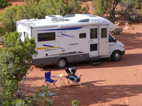
We made reservations to park the RV at their
new “RV
Park,” a beautifully situated two-site area with all hook-ups that
overlooks the canyon and Kanab River a mile from the Visitors Center.
(You can just make out our white RV through the trees. Plenty of shade
is a real benefit much of the year when the sun can be very intense.)
In the past we have left the dogs in the RV for the day, returning at
noon break to check on them and give them some exercise. This year,
Bella was unhappy and unsettled being left alone which she let us know
the
first morning we
went to work. We immediately changed our planned schedule: Hughes
worked mornings, while Judy stayed with Bella—hiking, relaxing,
etc.—and Judy worked in the afternoon. We went back and forth to our
assignment on our bicycles, about 5-6 miles each way. The weather was
blessedly cooler than we had experienced the previous part of the trip.
In fact, one night the water hose froze when the temperature dipped
well below freezing.
If you are interested in spending time volunteering
at Best Friends, check with them online, perhaps visiting
and taking a tour before you plan to volunteer; you’ll need a place to
stay (Best Friends rents cabins and cottages as
well
as the two RV sites; there are several good motels in Kanab five miles
away) and indicate your preferences for animals to work
with. We can’t speak for bunnies, cats, or pigs, but working with the
dogs
involves some cleaning duties, but most of the time is spent walking
the dogs—20-30 minutes per dog—and socializing the animals. An
assignment with horses involves taking hay and feed to the several
pastures on the property, some grooming, and, of course cleaning
pastures near the main buildings. Volunteers in the bird area (mostly
exotics: parrots, macaws, etc.) clean cages and floors, and provide
food and water. In the hot seasons, when the birds are outside, they do
like to get cool showers with the hose. There is a wide variety of
classes for volunteers on everything from drawing to animal
care.
We spent a little time at the end of each day
exploring the canyon near where we parked the RV and climbing to the
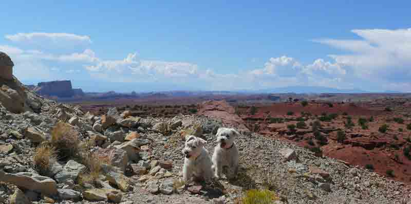
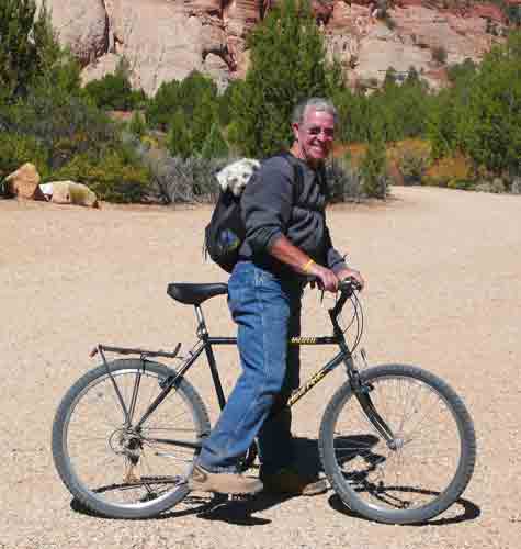
caves across the road from our camping spot. Hughes introduced Bella to
riding in his backpack, which came in handy riding through Kodachrome
Basin State Park, as well as at Best Friends. She never protested; in
fact, she seemed to like it more each time we put her in it. We also
checked the
memorial we placed at Angel’s Landing in honor of Gordie who came with
us from Ohio and taught Sophie the dog lore of our mountain area:
where squirrels and rabbits hide, how to handle elk, bears, and
deer, ways of avoiding coyotes, and dealing with the much larger dogs
that are more frequently found in mountain homes. Sophie passed that
knowledge on to Bella; the two were a great team for sniffing our
rabbits, voles, chippies and other small critters. We have arranged for
Sophie to have a
memorial at Angel’s Landing near Gordie’s.
UTAH
CAMPING
 In addition to RV parks in
Hurricane and Kanab, we found excellent camping at the following
campgrounds:
In addition to RV parks in
Hurricane and Kanab, we found excellent camping at the following
campgrounds:
•Snow Canyon State Park. We
needed a place to camp
near Santa Clara while Judy was preparing for the race, and Snow Canyon State Park, a
little over ten miles north of Santa Clara, provided us with
comfortable camping
in an area of spectacular scenery with great hiking and biking. The
narrow canyon is about 12 miles long (all uphill from the south
entrance to the end of the park road) and less than five miles wide,
yet there are over a dozen hiking trails through varied landscapes, as
well as paved and gravel roads for
biking. Technical climbers will find over 170 designated routes
covering the face of the Navajo sandstone cliffs. Our plan for a simple
overnight
expanded to three nights.
 Electricity and water hook-ups are
available for RVs
in the 14 closely bunched sites near the ranger station. Another 17
sites for tents or trailers are nicely spaced for privacy without
hook-ups. Hot showers are, of
course, for everyone, as is the most important feature of the park: the
shaded lawn area where one can sit or lie on the grass in the warmest
weather and yet be comfortable because of the shade trees. With
temperatures at or above 100°, we hiked in the morning, relaxed and
read on the lawn in
the
afternoon, and took an early evening hike or bike ride while the sun
was going down. The Whiptail Trail (paved) and the West Canyon Road
(gravel) were great for leisurely biking, a chance to see a great
variety of scenery. The Hidden Pinyon Trail (It took a while, but we
managed to find the lone
pinyon tucked away amid the more prevalent Utah junipers), the
Petrified Dunes Trail, and the Lava Flow Trail let us experience the
total variety of the park’s geology. Returning from each of the hikes,
our boots and socks were stained from fine red dust; Bella’s
wheat-colored
coat was as red as the Navajo sandstone. (Another feature of
Snow Canyon and other Utah State Parks: pets are allowed on leash on
all trails.)
Electricity and water hook-ups are
available for RVs
in the 14 closely bunched sites near the ranger station. Another 17
sites for tents or trailers are nicely spaced for privacy without
hook-ups. Hot showers are, of
course, for everyone, as is the most important feature of the park: the
shaded lawn area where one can sit or lie on the grass in the warmest
weather and yet be comfortable because of the shade trees. With
temperatures at or above 100°, we hiked in the morning, relaxed and
read on the lawn in
the
afternoon, and took an early evening hike or bike ride while the sun
was going down. The Whiptail Trail (paved) and the West Canyon Road
(gravel) were great for leisurely biking, a chance to see a great
variety of scenery. The Hidden Pinyon Trail (It took a while, but we
managed to find the lone
pinyon tucked away amid the more prevalent Utah junipers), the
Petrified Dunes Trail, and the Lava Flow Trail let us experience the
total variety of the park’s geology. Returning from each of the hikes,
our boots and socks were stained from fine red dust; Bella’s
wheat-colored
coat was as red as the Navajo sandstone. (Another feature of
Snow Canyon and other Utah State Parks: pets are allowed on leash on
all trails.)
•Kodachrome Basin
State Park. Nine miles of paved
road south of Cannonville off scenic State Route 12
is one of perhaps the most popular and best
known of Utah’s state parks. Named by the National Geographic Society
with the consent of the Kodak Film company because of the variety of
contrasting colors in the sandstone formations (and, we suspect, to
promote the recent release in 1948 or 1949 of Kodachrome film), Kodachrome Basin
State Park also protects
nearly 70 monolithic sand “pipes” created by injections of liquefied
sand shot through the sandstone base rock. Erosion left the remnants of
these pipes standing like giant fingers protruding from the ground. The
result is an array of spectacular and unique formations seemingly
placed at random throughout the park area.
Hiking in Kodachrome is excellent: short hikes (Angel’s
Palace, Panaorama Point, and
Sentinel Trails) lead
to
vistas that stretch to the edge of Bryce Canyon . Longer hikes (Cool
Cave and Grand Parade Trails) pass
hidden
slot canyons and shadowy caves. The half-mile paved Nature Trail was an
excellent opportunity to learn to identify the variety of plant life in
this
high desert region. On our final day, we drove to the trailhead to
explore
Shakespeare Arch, and to the site of Chimney Rock, an outlying monolith
pictured in
the September, 1949, issue of National
Geographic Magazine.
Camping in the park is scenic, fairly private, and
made comfortable even in warmer weather because of shade trees at every
site. However, we lucked into the one site in the park that had
electricity, water, and sewer hook-ups, plus internet service, plenty
of privacy and our own spotless washrooms—all for a few dollars more
than the regular campsites without any hook-ups. How did we do that??
Judy asked when we checked in, not in a whiney voice she assured me, if
there were any sites with
electricity. (After all, we expected
below freezing temperatures at night and we wanted to keep warm with
our space heater.) Yes, the ranger said. The host site near the ranger
station was available now that the host had left for the season, and we
could have that site for a few dollars more. Judy said that was good
for
her. Being close enough to the ranger station gave us wi-fi connection
we hadn’t counted on nor were we told about. However, we were also
a mile from most of the
trailheads. Rather than walk a mile on the paved road, we put Bella in
Hughes’s small backpack and biked to the
trails near the campground. Bella seemed to really enjoy the ride and
we saved two miles of walking on pavement each day.
As most visitors to the park will agree, in addition
to the hiking, the best feature of Kodachrome was the opportunity
for taking great photos—of landscapes and vistas, unusual and
imaginative formations, and desert plants. It was hard to choose from
among the scores of images we captured which ones to include on this
website or to make prints of for our album.
•Zion National Park.
We were a few miles from Zion National
Park poking
through the ghost town of Grafton
across the Virgin River from Rockville, and we remembered how impressed
we were when we last visited Zion. So, that afternoon we decided to
take a chance on
finding an available campsite in this very popular park. We got one of
the last
two sites in the South Campground,
a first come first served area with
180 sites without hook-ups. It took us a while to level the RV (which
was likely why it was one of the very last sites to be taken), but we
had shade and were next to the Pa’rus
Trail, a scenic paved pathway for
walkers and bicycles that runs several miles along the Virgin River
from the Visitors
Center to the Scenic Drive Junction.
We had visited Zion a few years ago and hiked the
major trails (Angel’s
Landing, the
Narrows, et al.). They were memorable hikes. This trip we had only
one full day
(and a dog who had to stay behind in the RV—park regulations), so we
opted to ride our bikes to the
Zion Lodge (not one of the
“great“ lodges in spite of its inclusion in a
book by the same title; the original lodge burned in 1966 and was
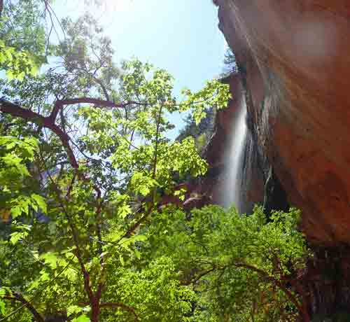
rebuilt in three months.) and walk the Emerald
Pools Trail System. This
easy, short (three miles round trip) multi-path trail leads to a small
oasis of water
seepage and a thin waterfall (at least at this time of the year)
cascading over a
large rock face overhang. It’s a lovely spot with nice canyon views.
The first evening we attended a campfire program on the geology of Zion
by a young woman who grew up near Boulder, Colorado. Another evening we
attended a less interesting campfire talk on stars/constellations. Some
just have a knack for presenting information in a more interesting
manner than others.
[It’s
odd that we still call these evening programs “campfire talks” because
we remember when there was a
campfire at the site of the talk, but it’s been years since we been to
one that actually had a campfire. In fact, our memories go back to when
there would be group singing before the program, sometimes with a piano
that was rolled out from behind the stage/platform to accompany the
group.]
•Jacob Lake
National Forest Campground (Arizona). When we finally left the Zion-St.
George area to make our way to Kanab, we had the choice to drive east
through Zion (waiting as all vehicles over 11' in height must in order
to drive one-way through the tunnels that were built when cars were
smaller and narrower); or we could drive south through the Arizona
Strip
and reach Kanab from the south via Pipe Springs National Monument and
Fredonia, Arizona. We had never been to Pipe Springs and knew nothing
of the reason for its existence. We did know that if we drove a few
miles out of our way to the south, in the direction of the north rim of
the Grand
Canyon, we would reach higher elevations where temperatures would be
well below the 95° range we had endured the past couple of weeks.
[The
Arizona
Strip, one of the last strongholds of the practice of polygamy, is
the area of northern Arizona that extends from the
Utah border to the Colorado River, which can’t be crossed except at the
northwest tip of Arizona (I-15 goes about 20 miles through the towns of
Beaver Dam and Littlefield as it hurtles down to Las Vegas) or on the
east side over Navajo Bridge bridge and the Glen Canyon Dam Bridge. It
is a bleak area where
few people have ever lived, save for small groups of Paiutes and,
temporarily, cattle ranchers. Its significance to folks in Utah and
Arizona is that Brigham Young claimed this area as part
of his Mormon Empire and worked unsuccessfully to
retain it when Utah became a state.]
We passed through the infamous neighboring border
towns of Hildale (Utah) and Colorado City (Arizona). We did not see any
of the alleged Mormon polygamists living there: actually it’s only the
women who can be spotted, because of their identical hairstyles and
their
identical dresses, and the small groups in which they seem to travel.
We suspect the men would “pass” anywhere.
Pipe Springs
National Monument, which is located on
the Kaibab Indian Reservation, ironically is a tribute to Mormon
settlers who built a fortification around a natural spring to protect
other Mormons from attacks by Paiutes and Navajos whose land was being
invaded. Our docent-guide seemed unaware of such historical
contradictions as she proudly took us through the grounds of the fort
which was restored by church and public funds. We were told by a ranger
that it depends upon the guide of the day which historical perspective
visitors learn.
South of Fredonia the land rises from the high
desert of the Paria Plateau into the Kaibab National Forest. Juniper
and
sagebrush give way to ponderosa and spruce forests. At 8,000' we left
the heat behind and relished the cool comfort of a landscape more like
home. Jacob
Lake names a crossroad
settlement (motel, gas station, RV park, and small grocery all in one),
a postage stamp size pond, and a national forest campground
where the
wind whispers through pines and the paths are softened by millions of
needles that cushion the otherwise rocky ground. We shared the
campground with a handful of other folks and saw no other hikers on our
walks into the nearby woods. This is not a destination, but rather an
overnight way-station for those traveling to and from the Grand Canyon.
We did, however, enjoy the cooler weather at least for a day.
UTAH BYWAYS
Ghost Towns.
Grafton, Utah,
is an old Mormon farming town—primarily cotton—gone ghost on the south
side of the Virgin River from Rockville, just few miles from the
entrance to Zion National Park. At the end of two miles of good road,
both paved and dirt, we found the cemetery and some of the original and
reconditioned buildings along with information on how and when the
community developed. A good effort by several local and state groups is
successfully capturing the history of this once important
town. Be warned: The road south past the cemetery, which connects
with the Smithsonian
Butte Scenic Backway, and on to SR 59 halfway between Hurricane and
Hildale, is intended
for 4-Wheelers and ATVs.
[Just
before the outbreak of the Civil War, Mormon
immigrants from South Carolina asked Brigham if he would relocate them
to a place where they could raise cotton as they had in “Dixie” just
before the Civil War; Brigham granted their wish and sent them to this
area. Grafton and elsewhere in SW Utah became, or had already become
know as “Dixie,” which accounts for St. George’s Dixie State
College, Dixie National Forest, as well as lots of Confederate
Flags, photos of Jefferson
Davis, and similar connections that show up here and there.]
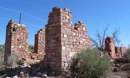
Silver Reef, Utah,
just off I-75 18 miles north of St. George, bet its future on silver
mining. John Kemple discovered silver in 1866, but only when he
returned eight
years later that he found the source in a most unlikely spot: a vein
that ran
through the local sandstone—the only spot in the country where that
geologic phenomenon occurs. Within a year the town of Bonanza City
boomed with
grocery stores, a half dozen saloons, a post office, several
restaurants, and a
Wells Fargo office. Bonanza City was soon renamed Rockpile and finally
Silver Reef. The bust came around 1886 when mine owners lowered miners’
wages
and the price silver dropped, turning Silver Reef into a ghost
town.
Attempts to revive the town persisted several times through the 20th
century, but each failed. Today, pricey modern houses are being built
on the site of Silver Reef, creating a neighborhood that abuts the
derelict buildings from the
town’s mining heyday. The Cosmopolitan
Restaurant boasts gourmet dining—“reservations recommended!“—next
to the Museum and Art Gallery across from the historic Wells Fargo
building.
Off the Main Roads.
 San Rafael Swell. Surrounding Green River
and on either side of I-70 is a large area multi-colored
sandstone, buttes, slot canyons, reefs, mesas, and rugged pinnacles
left over from a prehistoric ocean. Erosion and upheavals created one
of this country’s most imposing and beautiful natural wonders. The
government folks who write brochures for the BLM are skilled in
persuading visitors to use the public lands under their jurisdiction.
As we left Green River, we read through a brochure and looked at the
photos about the San Rafael Swell.
We were persuaded to drive through that area instead of going
straight to Hanksville on SR 24. We turned off on a pretty good graded
dirt road at exit 131 (Ranch Road) and headed for Goblin
Valley State Park about 30 miles away. The road surface was mildly
rough, occasionally washboard, and uncomfortable in a few places. The
stove, dishes, the contents of our bathroom cabinet and
overhead compartments flew around as we dipped and bumped our way along
roads intended for high clearance, 4-wheel drive vehicles. In fact, for
the next couple of hours we
saw only two trucks and several groups of ATVs. We
were not able, because of some very tough roads, to see all the areas
described. We did stop to hike around what looked like the remains of
some early exploratory digging, but were rewarded with the solitude of
the region and views of canyons and cliffs and high desert scrub.
San Rafael Swell. Surrounding Green River
and on either side of I-70 is a large area multi-colored
sandstone, buttes, slot canyons, reefs, mesas, and rugged pinnacles
left over from a prehistoric ocean. Erosion and upheavals created one
of this country’s most imposing and beautiful natural wonders. The
government folks who write brochures for the BLM are skilled in
persuading visitors to use the public lands under their jurisdiction.
As we left Green River, we read through a brochure and looked at the
photos about the San Rafael Swell.
We were persuaded to drive through that area instead of going
straight to Hanksville on SR 24. We turned off on a pretty good graded
dirt road at exit 131 (Ranch Road) and headed for Goblin
Valley State Park about 30 miles away. The road surface was mildly
rough, occasionally washboard, and uncomfortable in a few places. The
stove, dishes, the contents of our bathroom cabinet and
overhead compartments flew around as we dipped and bumped our way along
roads intended for high clearance, 4-wheel drive vehicles. In fact, for
the next couple of hours we
saw only two trucks and several groups of ATVs. We
were not able, because of some very tough roads, to see all the areas
described. We did stop to hike around what looked like the remains of
some early exploratory digging, but were rewarded with the solitude of
the region and views of canyons and cliffs and high desert scrub.
We’d heard some talk about making this area a
national monument or national park to protect the natural beauty and
cultural artifacts (petroglyphs can be found throughout the Swell), but
our suspicion is that the BLM is doing just fine providing a network of
trails for ATVs and 4-wheelers, with dispersed camping throughout. We
saw not a single animal during our time in the area, so wildlife
protection is not an issue. The Swell has its devotees, and several
books area available on its geology, history, etc. (e.g., Stone
House Lands: The San Rafael Swell by Joseph M Bauman, Jr. [Un.
of Utah Press, 1987]). However,
the area is an acquired taste and it’s not for everyone.
 State
Route 12.
Technically, State
Route 12
is a main road, but one that can be overlooked by
travelers heading through the state in a hurry to reach Salt Lake City,
Las Vegas, the
Grand Canyon, Denver, or San Francisco. Recognized
as an American
Scenic Byway, SR 12 starts on the south near Panguich
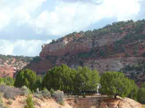
and turns east through Red Canyon
(shown in the photo here), a spectacular area of vibrant red
sandstone formations that are the equal of anything in Bryce. A paved
bicycle path has been recently constructed and will ultimately be
completed near the town of Tropic nearly 20 miles away. It is is well
worth stopping at the trailhead and taking
a quiet, leisurely ride through this remarkably scenic canyon.
Continuing to the north and
east, you pass through Cannonville (erroneously listed as a
ghost town in many sources, and where you turn to Kodachrome);
Hennrieville (where a major CCC camp housed hundreds of men
through most of the 1930s until WW II); Escalante and Boulder (the 27
miles between these two small towns offers visitors some of the most
awesome and varied geologic formations anywhere in the country. There
aren’t enough pull-outs to take all the photos you’d like.); and north
into the higher elevations and tall trees area of Fishlake National
Forest where the camping is outstanding. The end comes in Torrey where
SR 12 intersects with State Route 24 and travelers can choose to go
east to Capital Reef National Park, or west to Richfield or Salina and
I-70. SR 12 is 120 miles of great diversity and landscapes that will
take your breath away.
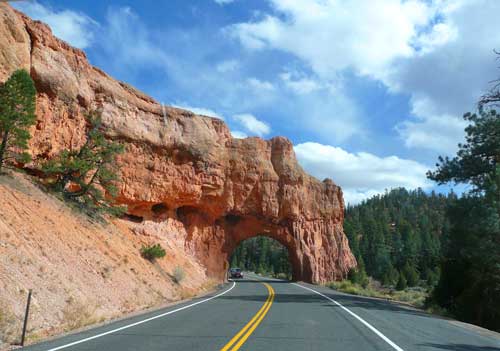
State
Route 12.
Technically, State
Route 12
is a main road, but one that can be overlooked by
travelers heading through the state in a hurry to reach Salt Lake City,
Las Vegas, the
Grand Canyon, Denver, or San Francisco. Recognized
as an American
Scenic Byway, SR 12 starts on the south near Panguich
and turns east through Red Canyon
(shown in the photo here), a spectacular area of vibrant red
sandstone formations that are the equal of anything in Bryce. A paved
bicycle path has been recently constructed and will ultimately be
completed near the town of Tropic nearly 20 miles away. It is is well
worth stopping at the trailhead and taking
a quiet, leisurely ride through this remarkably scenic canyon.
Continuing to the north and
east, you pass through Cannonville (erroneously listed as a
ghost town in many sources, and where you turn to Kodachrome);
Hennrieville (where a major CCC camp housed hundreds of men
through most of the 1930s until WW II); Escalante and Boulder (the 27
miles between these two small towns offers visitors some of the most
awesome and varied geologic formations anywhere in the country. There
aren’t enough pull-outs to take all the photos you’d like.); and north
into the higher elevations and tall trees area of Fishlake National
Forest where the camping is outstanding. The end comes in Torrey where
SR 12 intersects with State Route 24 and travelers can choose to go
east to Capital Reef National Park, or west to Richfield or Salina and
I-70. SR 12 is 120 miles of great diversity and landscapes that will
take your breath away.
Hell’s Backbone.
Hell’s Backbone Road
is a 30-mile loop road of good graded gravel that
connects Escalante and Boulder on the north side of SR 12. The
road passes by ranches, climbs through thick growths of ponderosa and
spruce, approaches the
Box-Death
Hollow Wilderness Area, and national forest
camping, both dispersed camping and at two campgrounds that are open
seasonally. On this trip our interest was in locating what was supposed
to be a prime area for finding good jasper, that blood red agate that
polishes into beautiful pieces for jewelry. To get there, we drove to
Boulder and turned north on the Hell’s Backbone road. We drove only
five miles up, past ranches and green pastures that belie the name of
the area, to a spot where red jasper and agate litter the ground just
off the road. It was as James Mitchell described in Gem Trails of Utah (Gem Guide Book Co., 2006):
“The agate and jasper is so brilliantly red here that you can actually
see it among the pine needles from your vehicle as you travel.” You got
it right this time, James. We carried off all we could stuff in our
pockets.
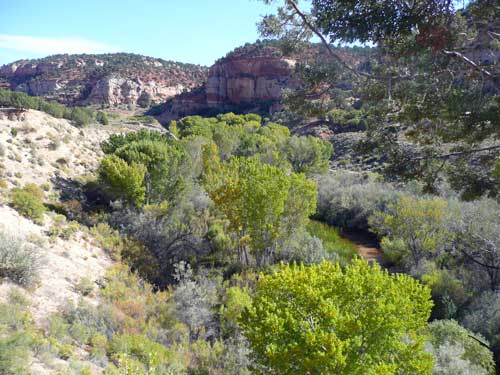
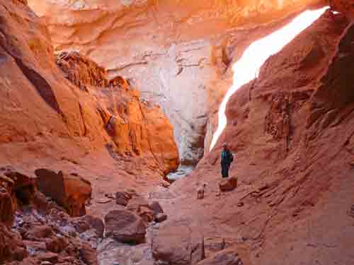
The Burr Trail.
We had known about the Burr Trail, but
had avoided it in the past because we
were not sure of how good the surface is. The trail (which is, of
course, really a road) begins in Boulder, enters Long Canyon (shown in
the photo) about five miles later, and continues for some 67 miles
through The Grand
Staircase–Escalante National Monument, across the
south part of Capital Reef National Park, and ends at
Bullfrog Marina on Lake Powell. We learned when we stopped at the
Monument Headquarters in Cannonville, that
the first 31 miles of the Burr Trail is
paved. The next portion through
Capital Reef is rough dirt, and the last 15 or so miles to Bullfrog is
also paved. That gave us the green light to take our RV at least the
first
31 miles, which includes one of the most scenic areas we visited in the
entire trip. The National Park Service provided a
mile by mile description of what visitors can see along the Burr
Trail.
The drive through the narrow red
sandstone of Long Canyon on the Burr Trail is spectacular. We
could have stopped for photos every minute of the way. The sheer walls
and formations we passed through almost shoulder to shoulder reminded
us of Canyon de Chelly at its finest. Like most of Utah, the landscape
changed from flat farming areas to dramatic cliffs to open valleys and
flat high desert. The small
campground at Deer Creek (six sites, no water,
$4/night) has lots of cottonwoods for shade, but we
found the quietest place on earth for our overnight on the banks of an
unnamed wash about five miles from the end of the pavement. Surrounded
by juniper and pinions, we parked our rig in a secluded flat area 100
yards off the
Burr Trail where we walked the creek bed in search of rocks and
petrified wood. We sat in the shade for our afternoon cocktails and
listened to birds and crickets as the sun set. While we were
there we were the only people for miles: no sounds, no traffic, no
movement, and so many stars! We will return again, the next time for
several days of hiking and mountain biking using this spot for
our base camp.
AN IMPORTANT POSTSCRIPT
Losing Sophie was losing a member of the
family. If
you have pets, you know the heartbreak when an animal is taken from
you.
Three weeks since returning we are still grieving. We will get through
the experience, but we’ll not get over it. If you’ve lost a pet—a
member of your family—you know the truth of this.
However, good advice from friends convinced us that
adopting another dog would help both us and Bella, who has not ever
known life without Sophie and who mourned the loss of Sophie in her way
as much as we have. After a couple of weeks being home Judy worked the
internet for days looking for just the right dog to become Bella’s new
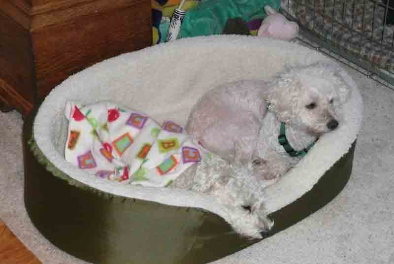
best friend. A week went by before we found Lucy, who, Judy maintains,
is Sophie’s gift to us. In so
many ways Lucy has many of Sophie’s traits: she’s alert, curious, and a
quick learner; she is
friendly toward people and other dogs, especially Bella. She
is a
four year old poodle-bichon mix presently with short white hair (a
close cut at the shelter) and very pink
skin and has had at least one litter of puppies. After just
one
week with us, she and Bella
already share cuddle beds and sleep together, and Judy knows she will
become a hospital therapy dog just as Sophie was. She has won our
hearts.
Best of all, she makes us all happy again.
